Big rivers rock!
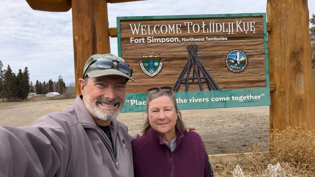
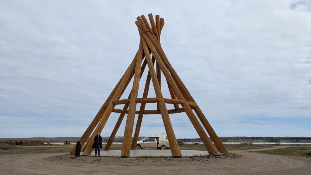
Fort Simpson is an old trading post established by the Hudson Bay Company in 1828, strategically positioned at the merger of the Liard and Mackenzie River so that they could control and support all the trade in that area. Today it is officially home to about 1,200 mostly First Nations people who live with an eight month winter and some serious isolation. So isolated in fact that the only way to drive there is to take a ferry.
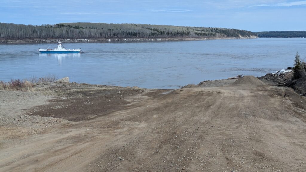
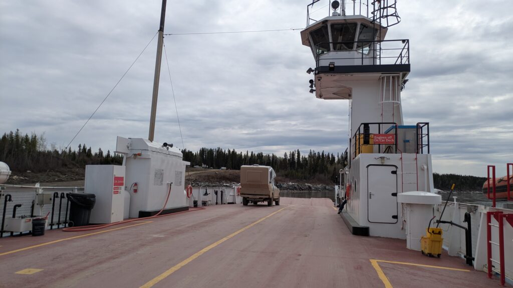
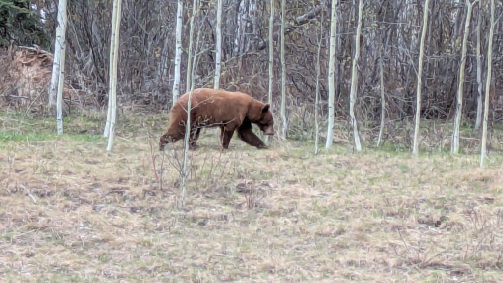
After a two bear morning we arrived at the ferry to cross the Liard River on our mission to visit Fort Simpson. The ferry had only started running five days ago after the river broke up and the ice floated away. The Liard is a flat but fast moving river six feet higher than normal and a force to be reckoned with, even though it is the little brother to the nearby Mackenzie River.
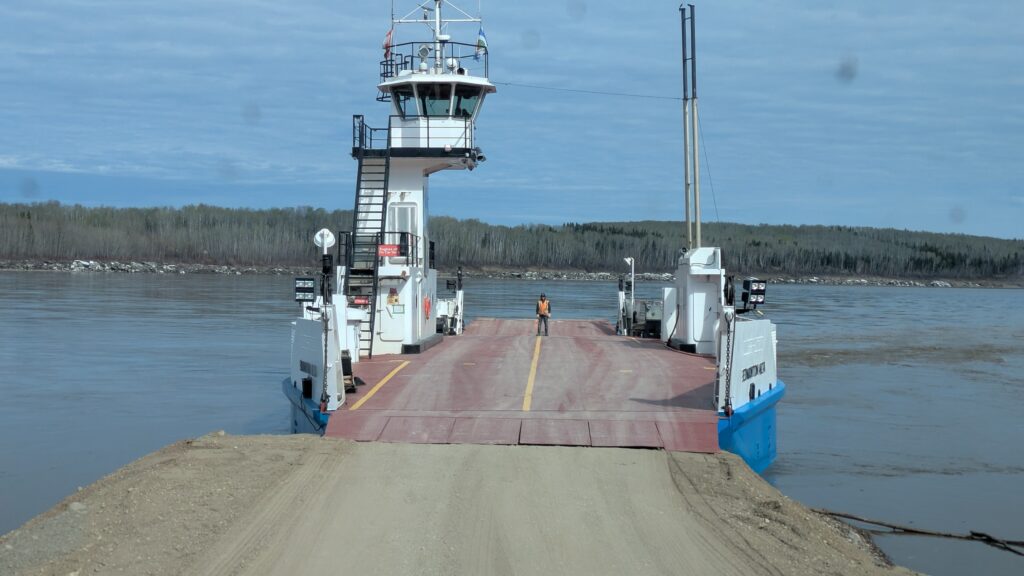
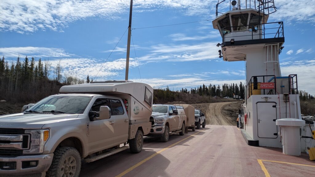
The ferry master drove up to the dirt loading ramp they only built last weekend and we drove on. A couple more locals drove on and we were away – immediately taken downstream by the current but then powering across the river and running aground on the ramp on the other side. Mission accomplished.
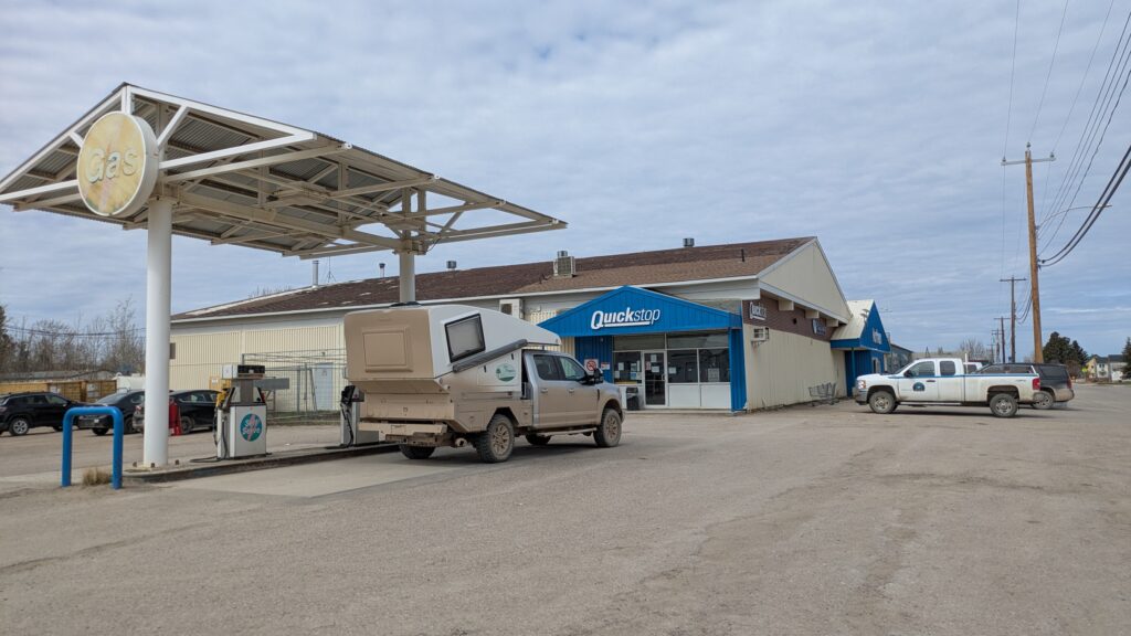
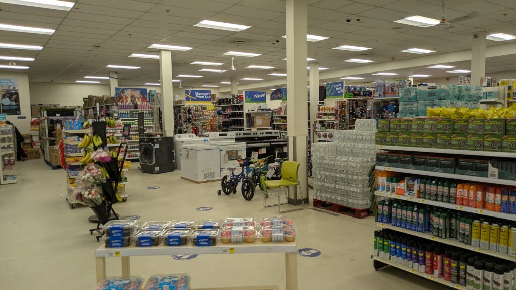
These small towns have become very familiar to us after the last few weeks. They all have a Northern store, a chain formerly run by the Hudson Bay Company and offering a little bit of everything someone might want. The Northern store in Fort Simpson was large with a substantial supermarket section and another large area for furniture, toys, clothing, household goods, hardware items and much more. Whatever you need, Northern will probably have it.
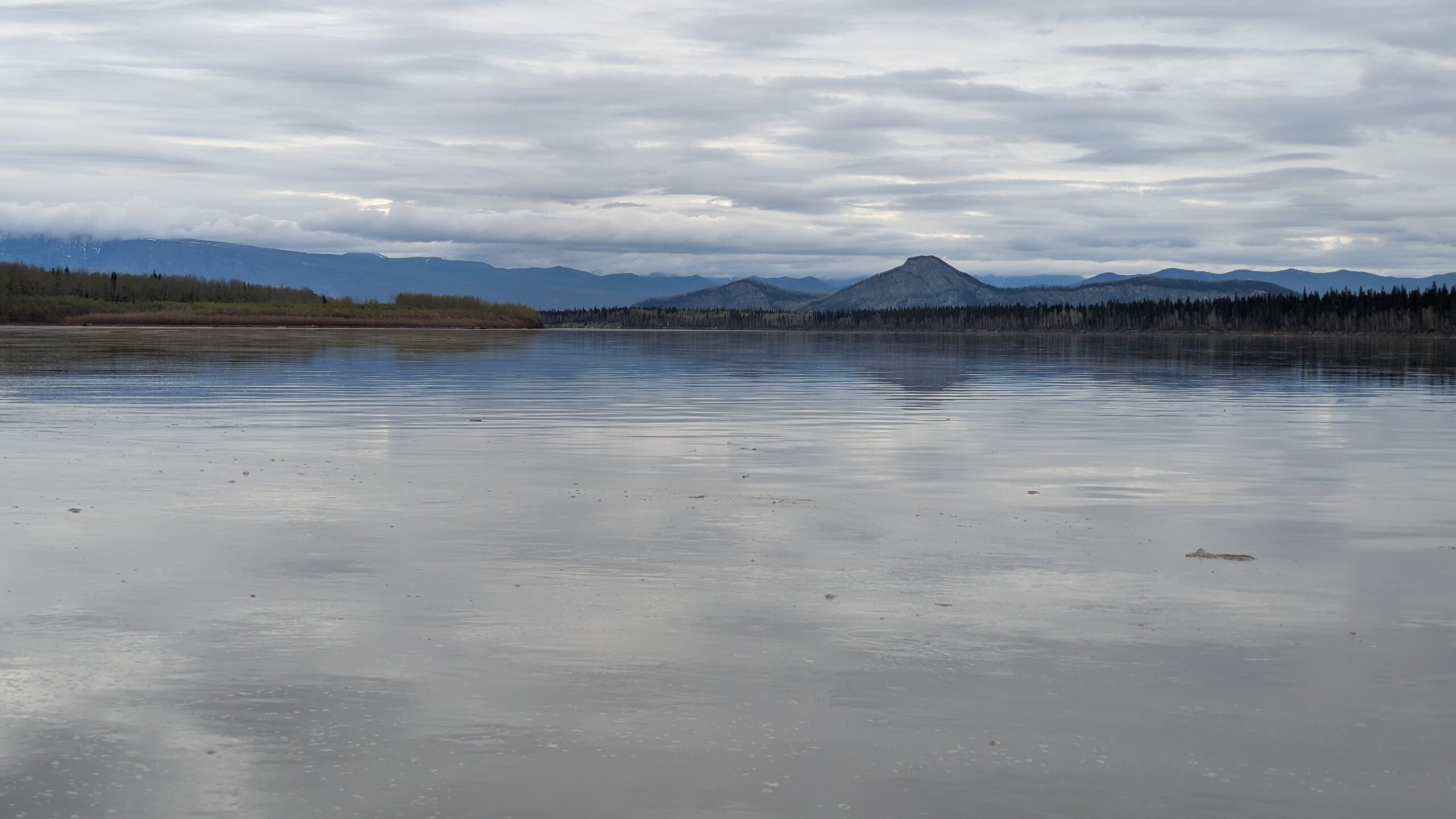
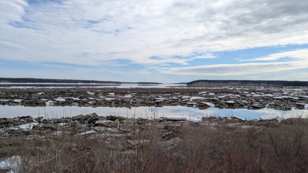
We drove along the rivers’ edge and admired a mighty geographic scene – where the huge Liard River merged with the even more huger Mackenzie River. The banks of these rivers were still lined with massive icebergs which hadn’t floated away and hadn’t melted yet, making the whole scene just spectacular. It is with this wonderful scene before us we had lunch and spoke to two locals, one a local Dene chief, about life in Fort Simpson.
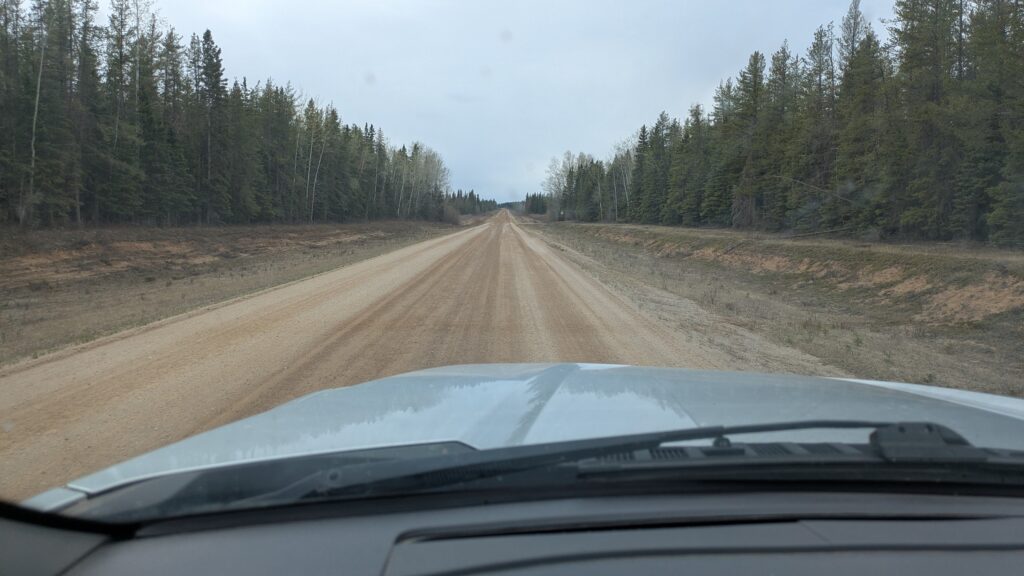
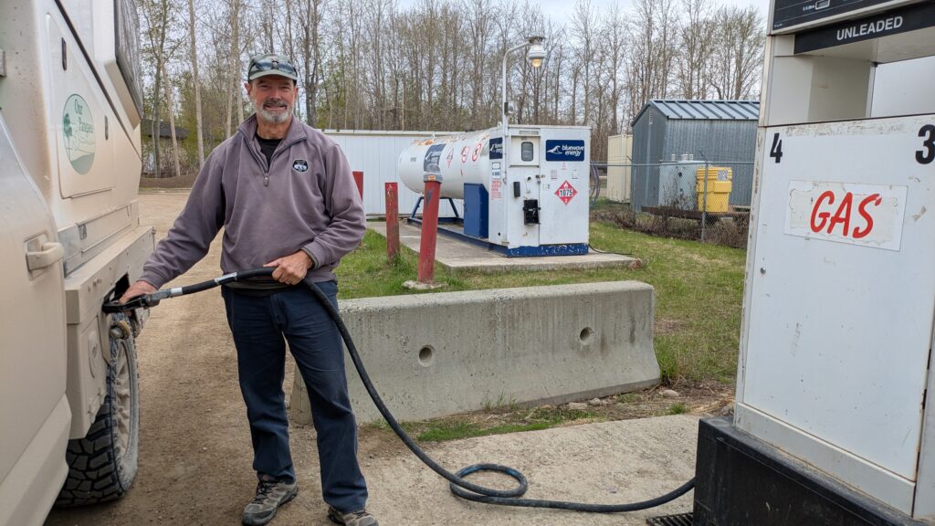
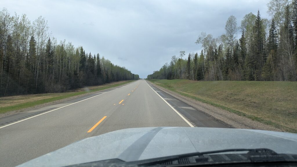
We explored the town, such as it was, and refuelled (at the Northern, of course) before heading back to the ferry which we had all to ourselves for the return trip. From there we pointed southward, following a dirt road (well, actually Highway 7) for a couple hundred kilometres. We took one detour down to the Liard River and dined out on this beautiful peaceful scene with the wild all around us. Two trumpeter swans flew overhead blowing their horns as they passed by.
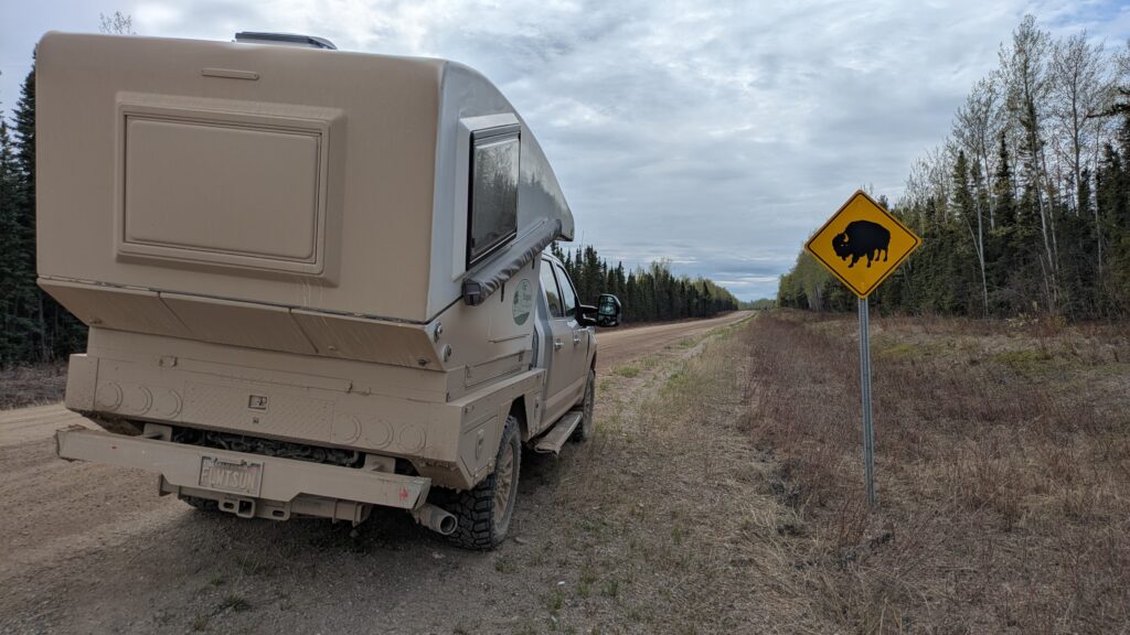
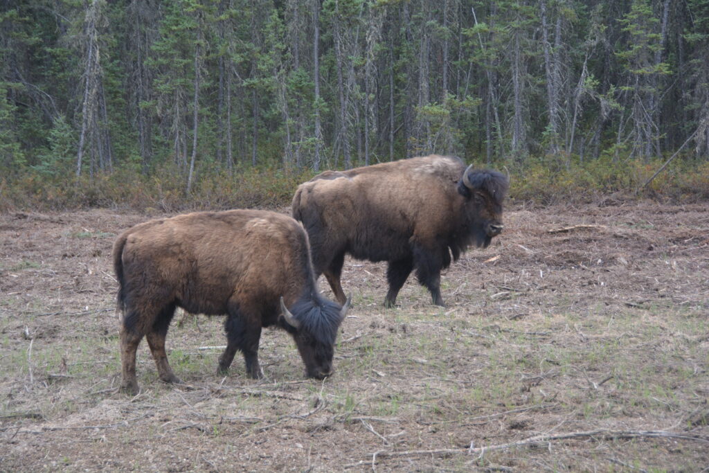
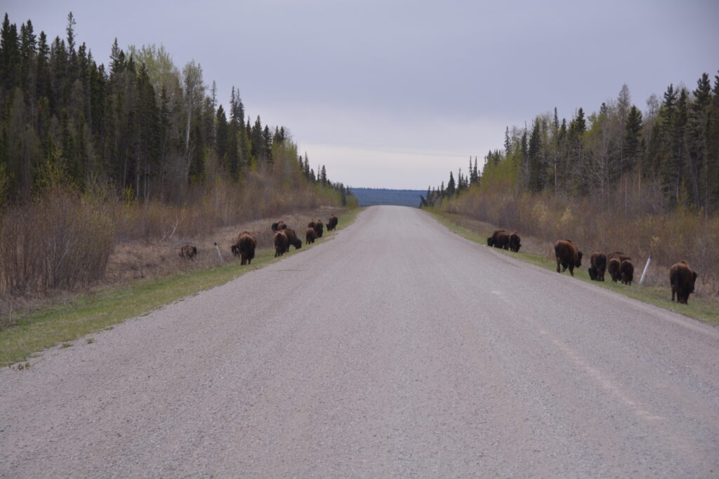
We camped that night in a large clearing a little way off the road, having spent two and a half hours driving without seeing a single other car in either direction. Overall for the day we saw four bears, a few bison herds and one cute beaver who was beavering away near the road when we stopped to say hello.
The next morning we woke to a big bear sniffing around us at the edge of the clearing. Luckily for him he knew he had met his match with a sleepy me and disappeared into the thick forest.
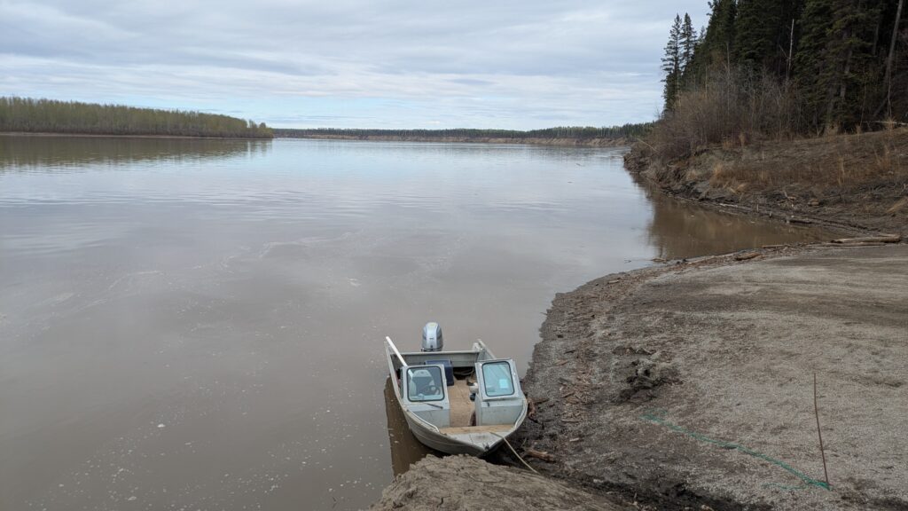
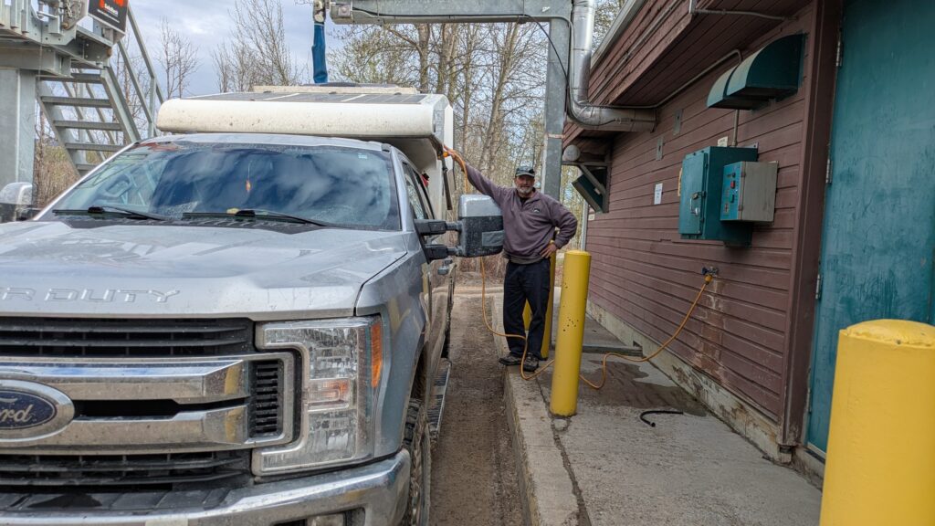
After an hour of driving we pulled into Fort Liard, population about 500 First Nation people, for fuel, a high-pressure wash of Tramp and to fill up his water tank. We gazed out at the beauty of the river flowing past the town and the wildness of the mountains all around. Fort Liard delivered everything we asked for.
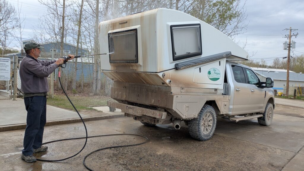
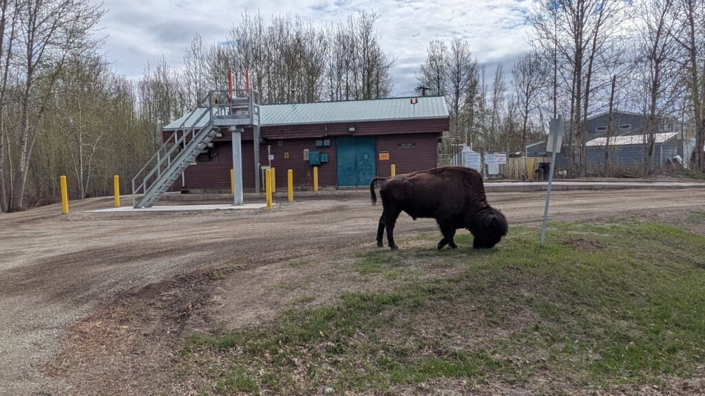
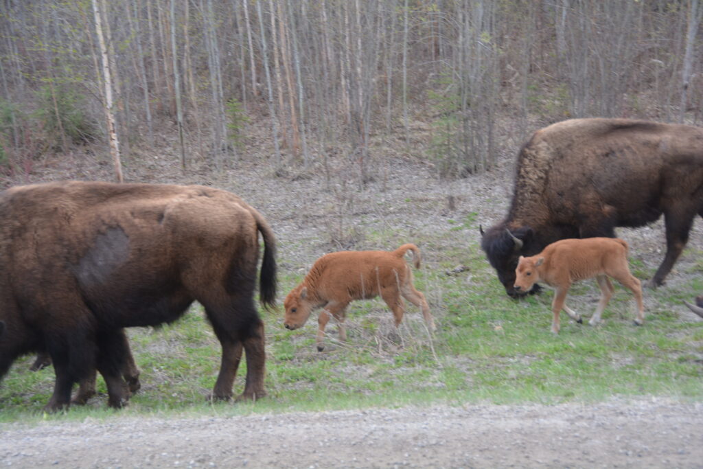
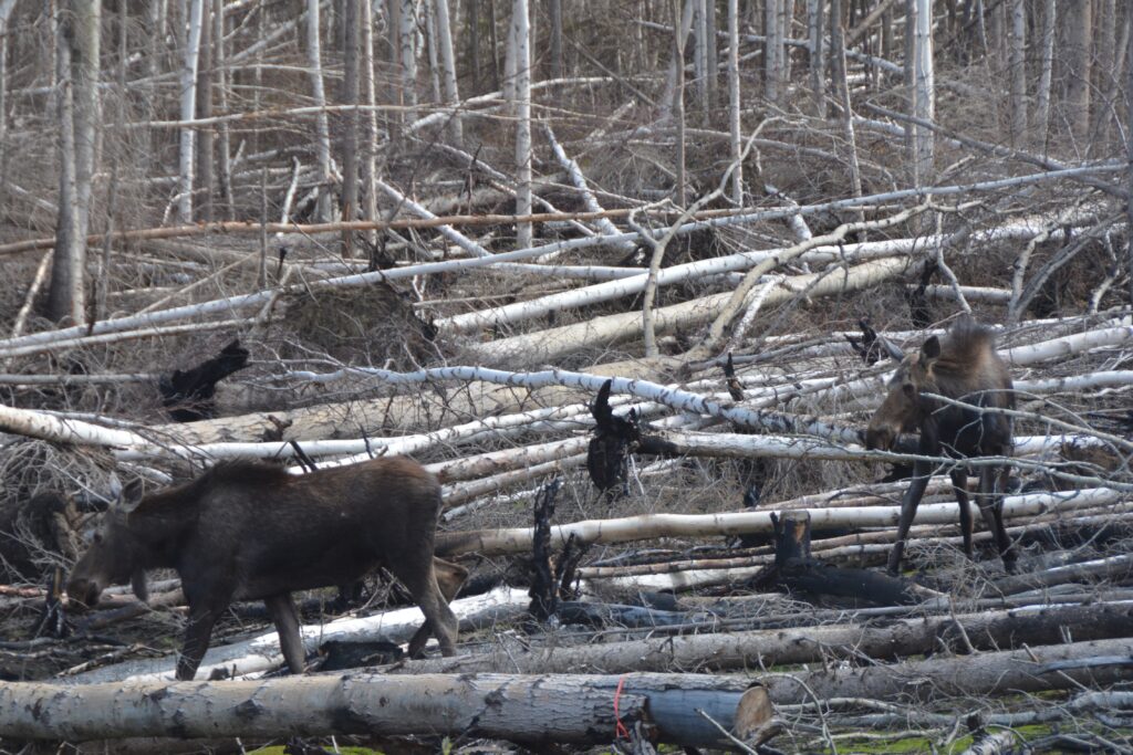
From Fort Liard the road turned to bitumen again, a nice change since we had just given Tramp a good wash, and as we drove south we saw multiple bears and two moose plus the largest bison herd so far with 20 adults and two cute little calves. And on top of all else there were the budding green poplars, the black and white spruce and the snow-capped mountains. Loving it.
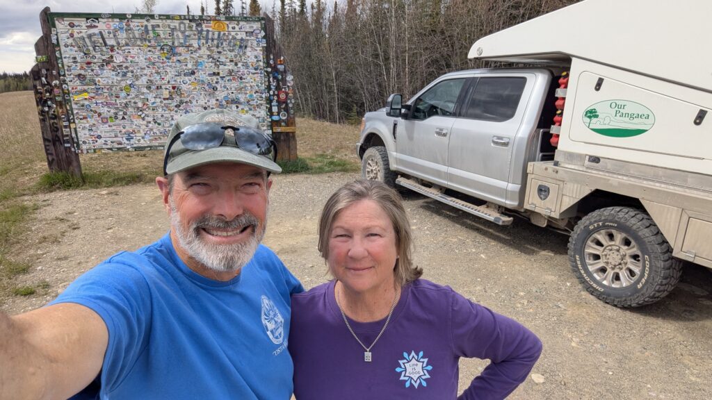
We crossed into British Colombia, because roads do not simply go from A to B but must follow the path of least resistance through the mountains and over the wide rivers. We hit the famous Alaska Highway, which we had posed for a photo at it’s starting point in Dawson Creek, and turned north towards Alaska.
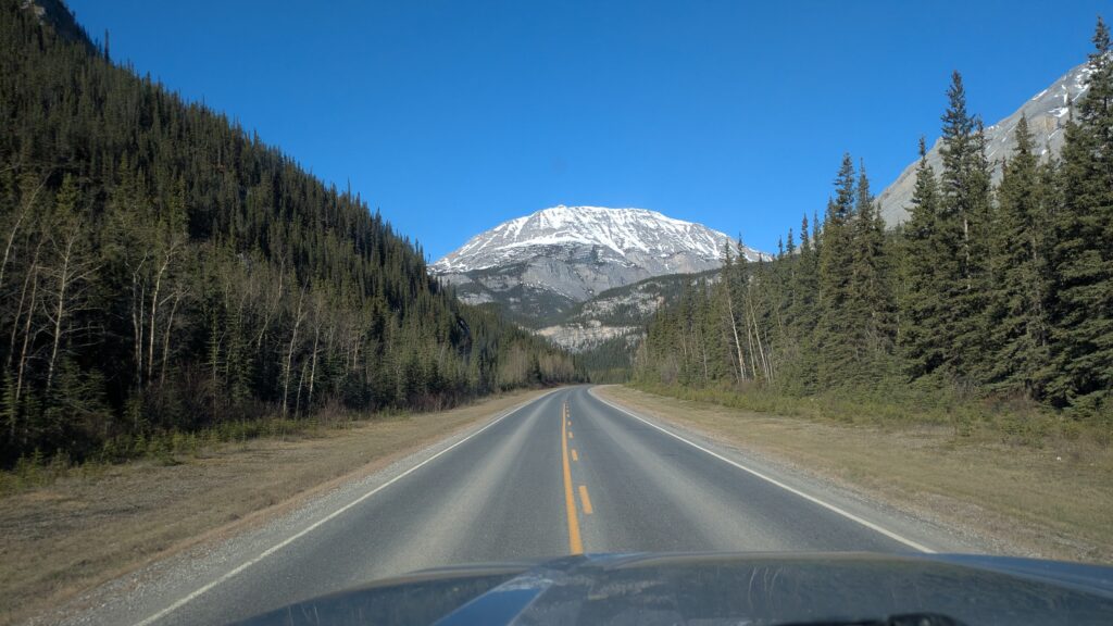
The road started out wide, smooth and fast, at least by our standards, and the views became even bigger and better. As we climbed the first pass at over 1,000 metres (3,300 feet) there was freshly fallen snow at our feet and on the mountains above.
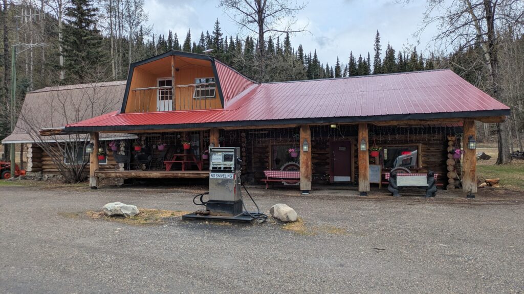
At Toad River Lodge we stopped for a world famous cinnamon bun (even I thought it deserved it’s reputation) and kept climbing upward.
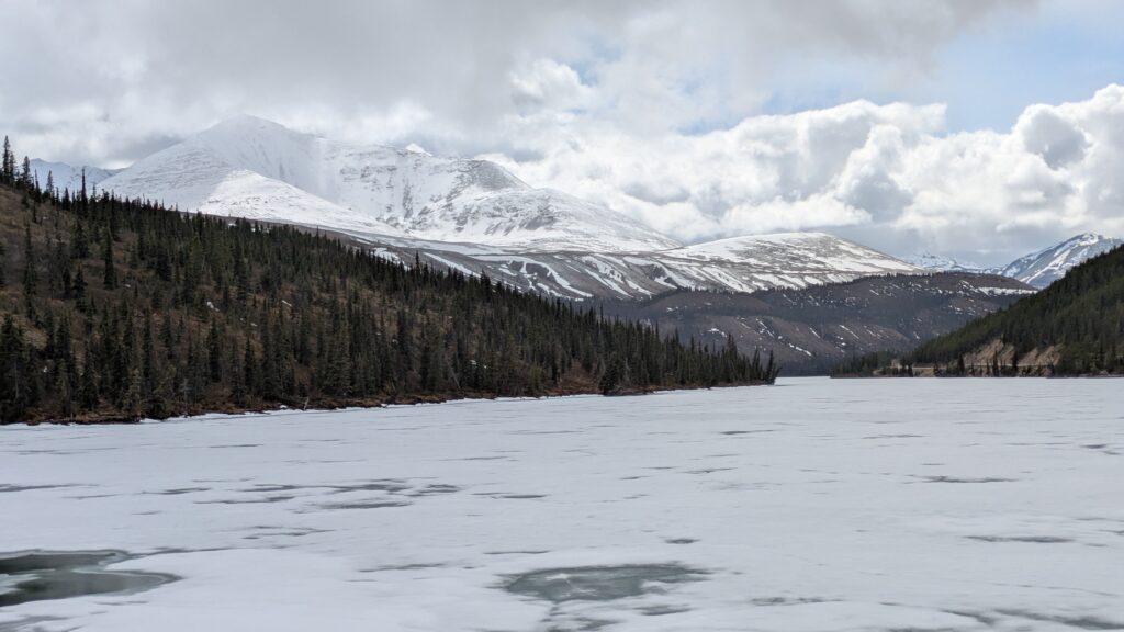
At Summit Lake there was still thick ice on the lake and thick snow up above and we were humoured by how the weather changed from minute to minute. The winding road followed rivers, pierced valleys and climbed mountains passes, looking absolutely spectacular.
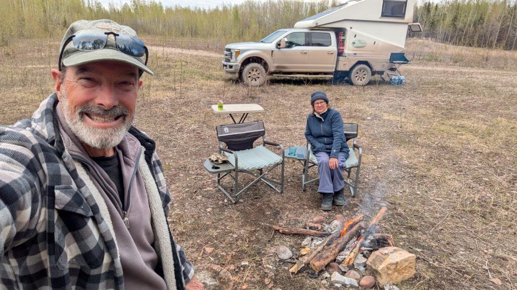
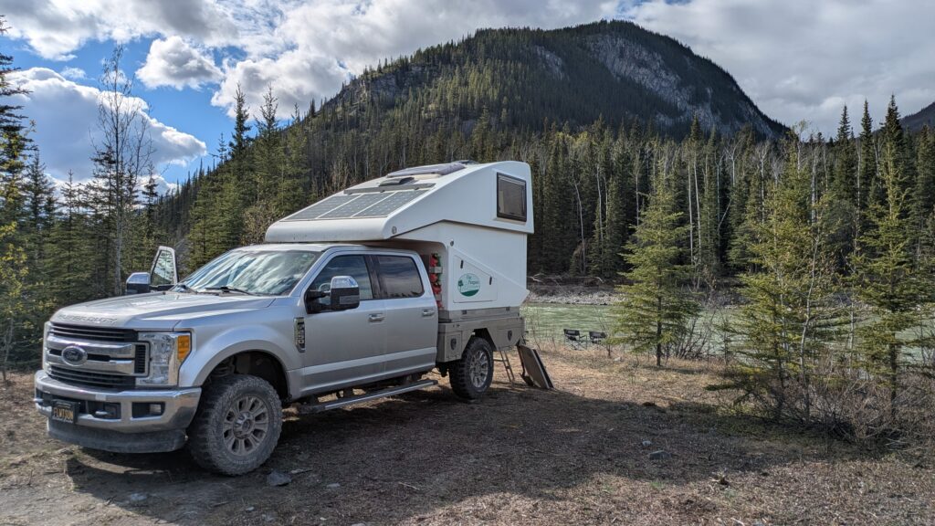
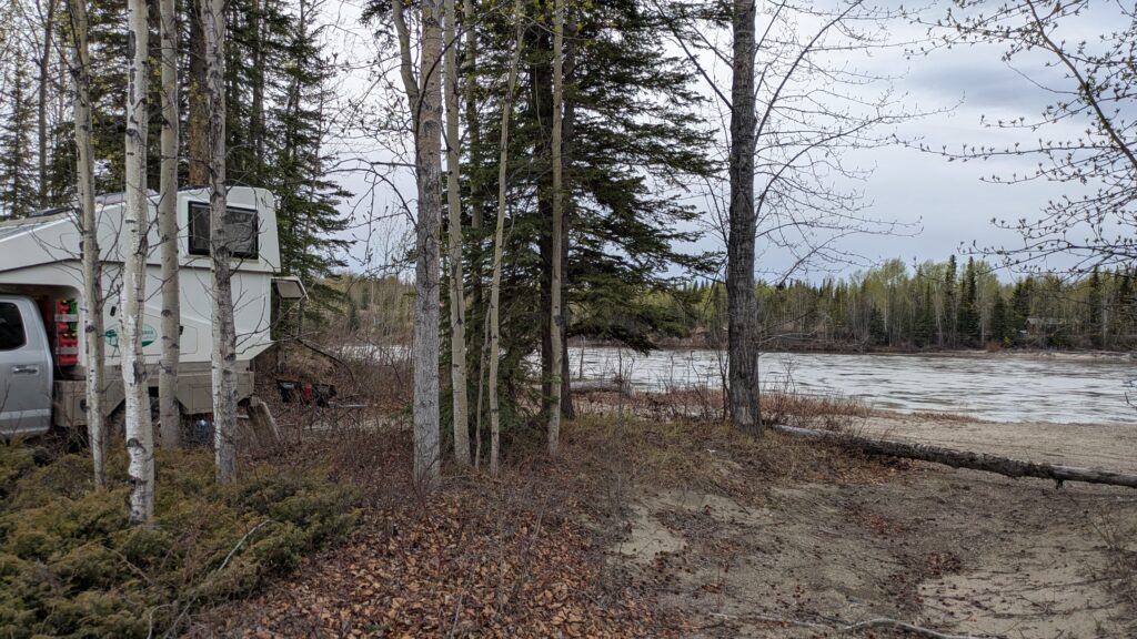
We camped for the night literally on the banks of the Toad River, enjoying the snowcapped mountains nearby and the clear snow-fed water after a couple of weeks of muddy chocolate brown rivers. The hot fire and therapeutic river noises topped off a long but beautiful driving day.
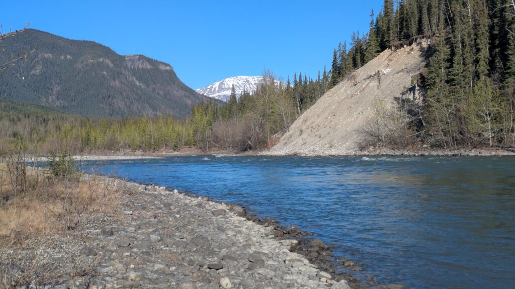
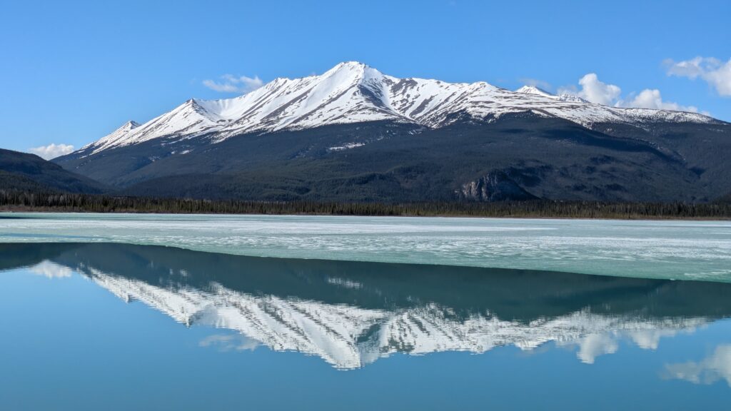
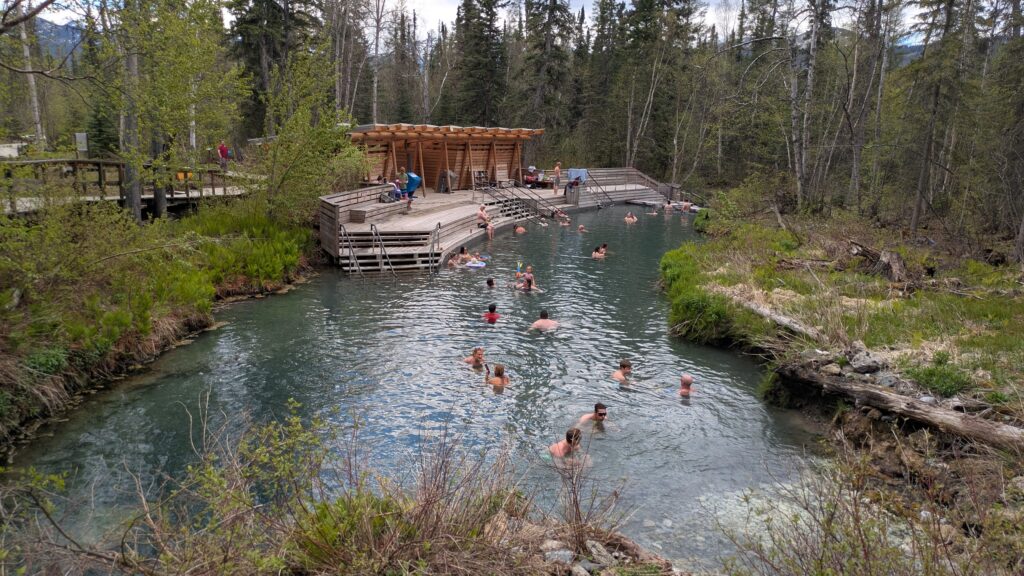
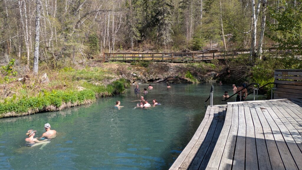
The next morning was seriously frosty but with clear blue skies as we headed into more stunning mountains topped with snow while the Toad River raced along beside us. We arrived at Liard River Hot Springs in late morning and enjoyed a beautiful hot soak in the wonderful natural hot springs.
We had been here nine years before and wondered what commercial changes might have taken place but the hot springs were only $5 and everything else about it was exactly as we remembered. An absolutely delightful, relaxing and cleansing experience. Long live hot springs!
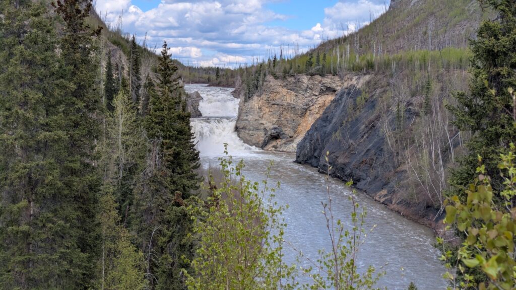
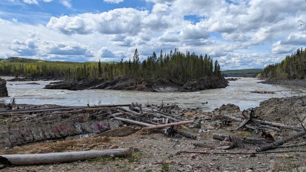
We continued along the Alaska Highway, detouring once to see the spectacular Smith River Falls and another time to see the Whirlpool, where the Liard River twists and turns through some tight bends. It seems like wherever we go we have these wonderful big rivers to enjoy.
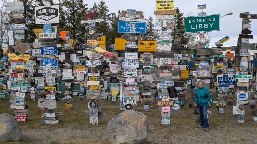
We crossed over in the Yukon Territories – yea! – before finally reaching Watson Lake. When the US army built the Alaska Highway in 1942 – and took only eight months to do it, thank you very much, Watson Lake was a small support community for the military personnel and locals who were helping them.
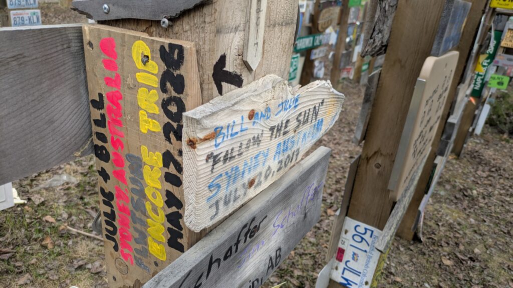
When one homesick American soldier painted a sign with his home town on it he started a tradition – some would say a craze – that has grown ever since. Travellers passing through Watson Lake on the way to Alaska bring with them, or paint one when they arrive, a sign representing their home town or their adventurous journey to the north. Unbelievably, there are currently over 120,000 signs on the posts and trees with dozens, sometimes hundreds, being added every day.
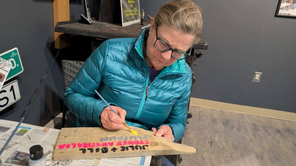
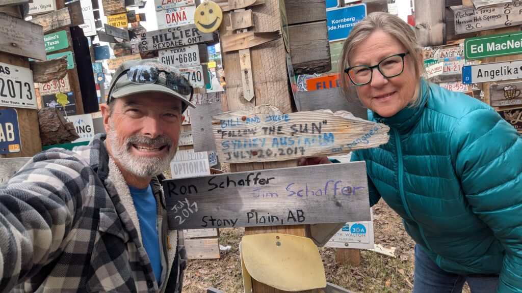
Julie and I did the same in 2017, painting it with paint from the Tourist Information on a board that the previous day was designated firewood. And so we did the exact same thing this time – resurrected a board, pained our message and nailed it to the post where our old sign was.
Except…it wasn’t that easy. It took us almost an hour wandering amongst the forest of signs before we found our old sign. In the end it was mission accomplished and if we come again in nine years time we’ll try to remember where our signs are.
We camped that night on the banks of the Liard River – again! – and enjoyed this familiar river one more time. We loved how fast it flowed, carrying huge trees with it and with a deep uninviting chocolate brown colour. Rivers are cool and we know we have more to come as we inch our way closer to Alaska.
Comments
Big rivers rock! — No Comments
HTML tags allowed in your comment: <a href="" title=""> <abbr title=""> <acronym title=""> <b> <blockquote cite=""> <cite> <code> <del datetime=""> <em> <i> <q cite=""> <s> <strike> <strong>