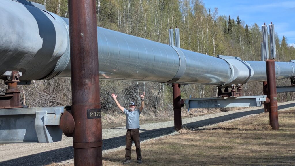
The Alaska Pipeline
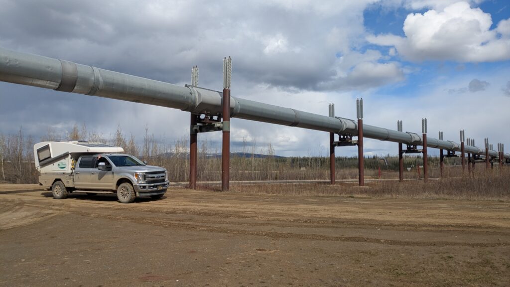
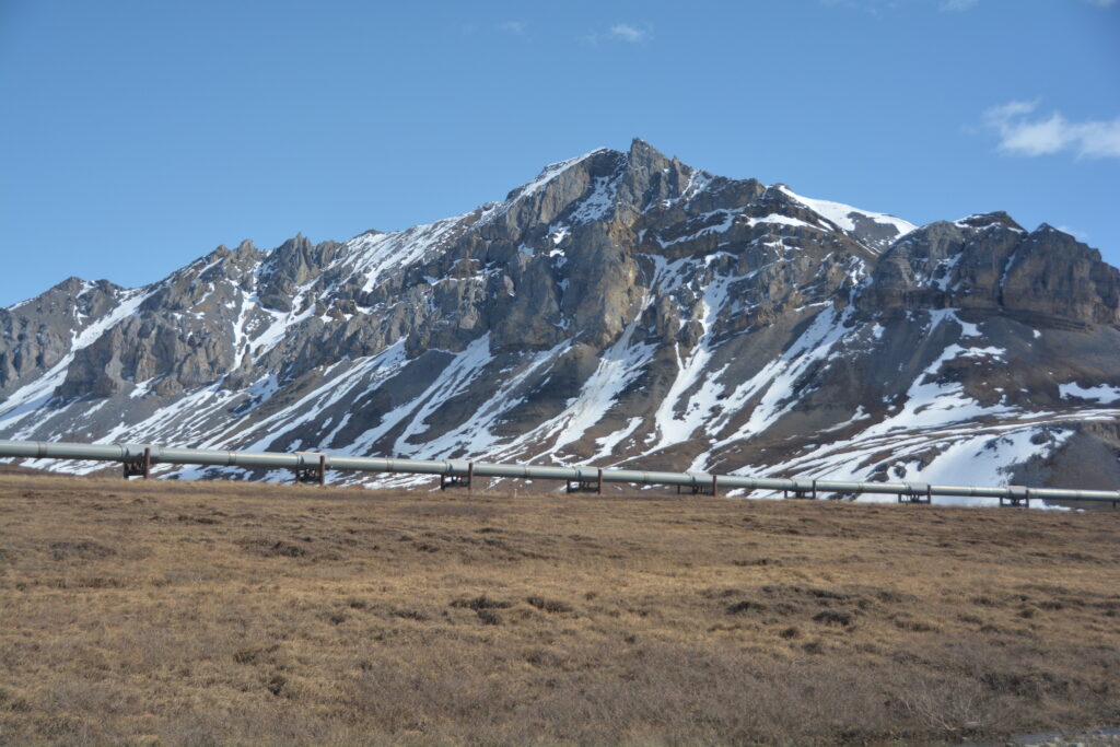
In 1968 oil was discovered up in the Arctic Ocean at Prudhoe Bay off the shores of northern Alaska. That moment changed everything for Alaska, and the entire United States for that matter, but the first task was to find a way to move the oil to an ice-free port so it could be shipped to the rest of America. And the ingenious solution was an 800 mile (1,290 kilometre) pipeline over three mountain ranges, across countless rivers and through some of the most remote land in the world. Amazingly, by 1975 they had completed the pipeline and while doing so they built a road along the pipeline to maintain it. And we were going to drive that road.
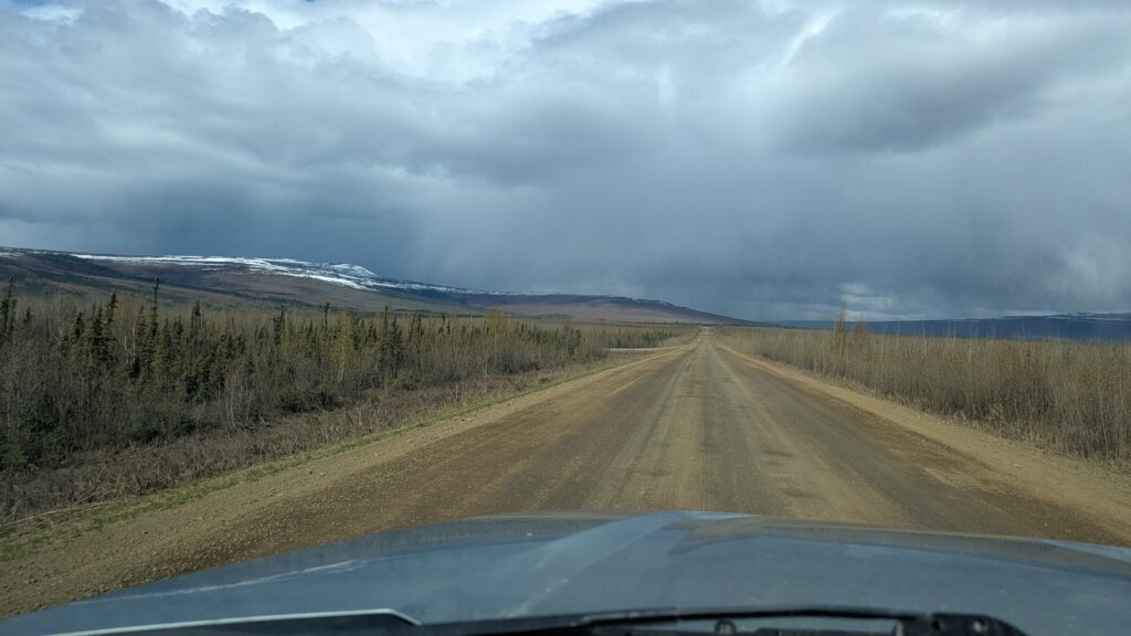
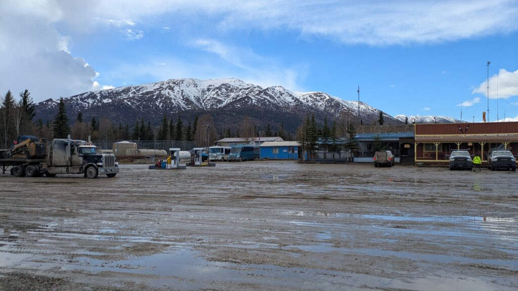
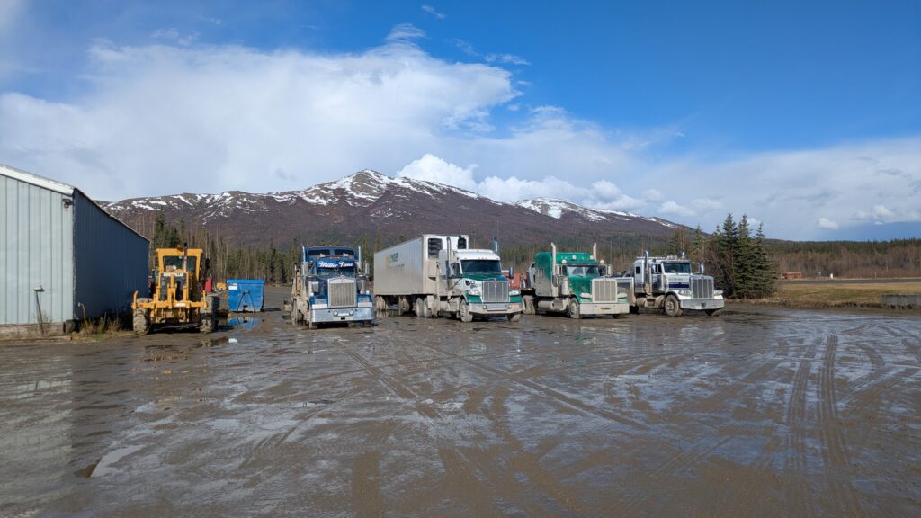
The Dalton Highway, or the Haul Road, as the Alaskans call it, starts in Fairbanks and runs 500 miles (800 kilometres) almost due north until it reaches Prudhoe Bay. It is essentially a company road built and kept open year round to maintain the vital Alaska Pipeline. Every day a hundred or more huge trucks move up and down the road delivering goods, machinery, people and material to support this massive engineering endeavour. And the road is open to the public if you have the right vehicle and the right frame of mind. That’s us!
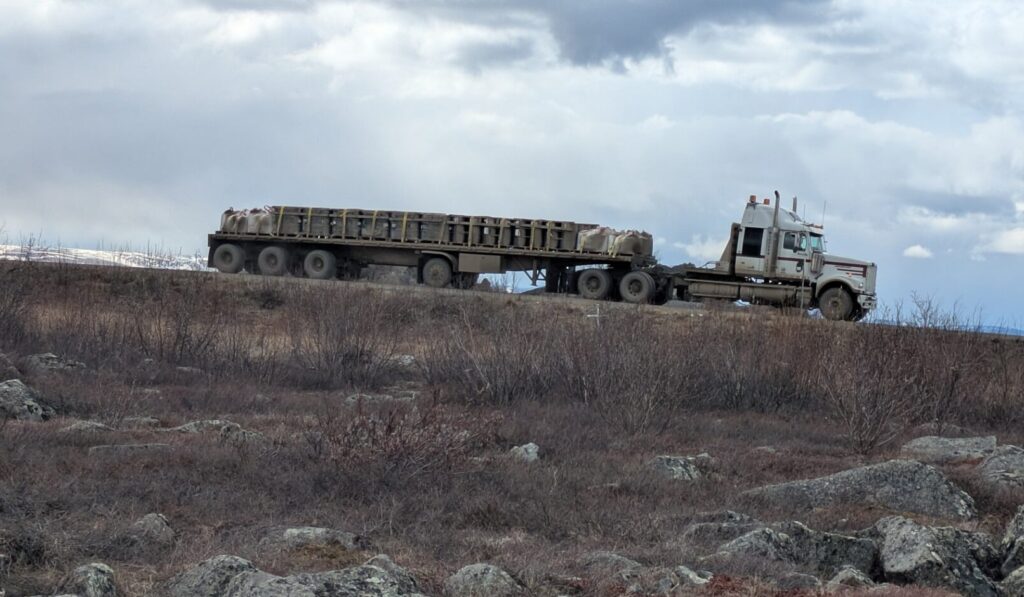
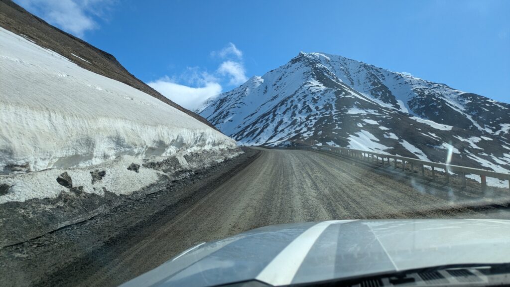
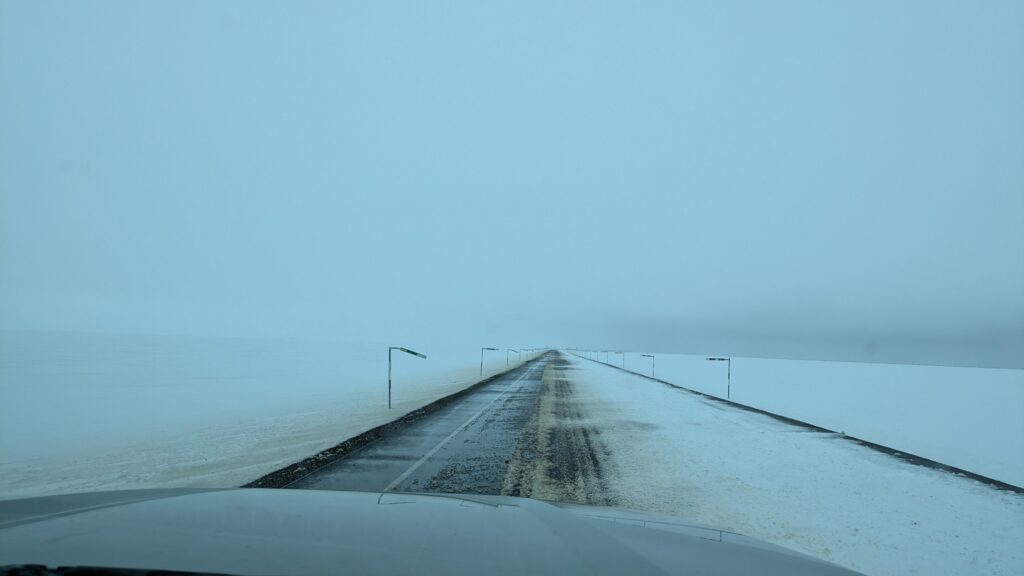
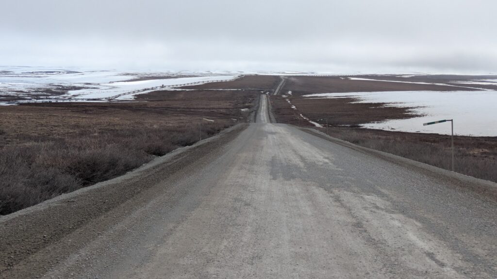
But the road is in notoriously bad condition, mainly because of the harsh winters and the melting permafrost which turns some sections into a rolly-polly children’s ride with most of it a gravel or dirt surface and potholes the size of refrigerators.
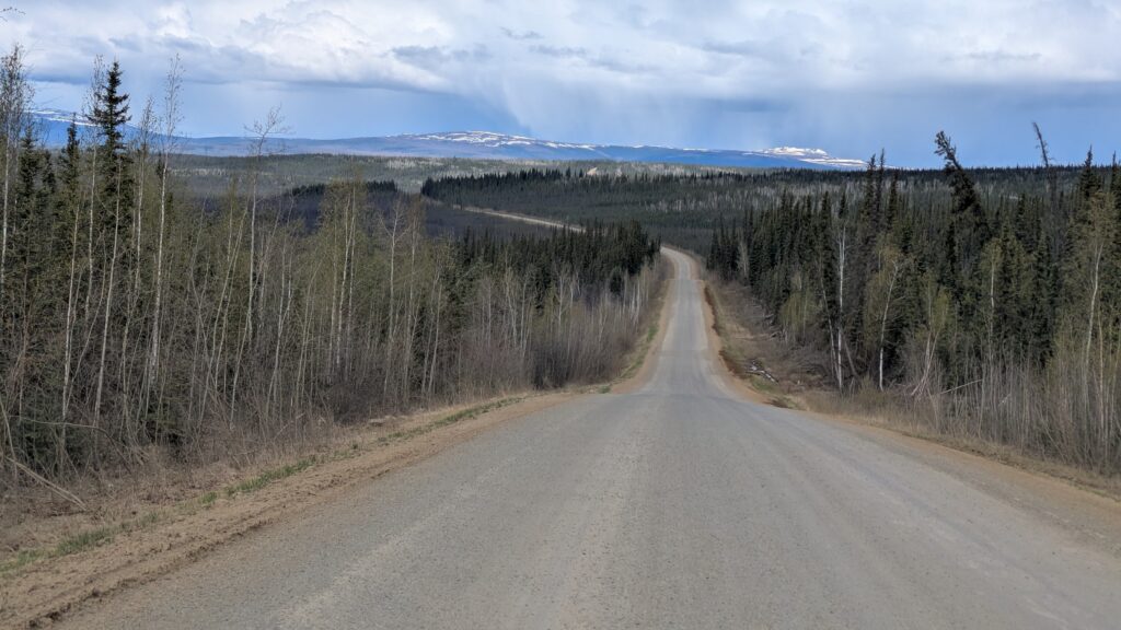
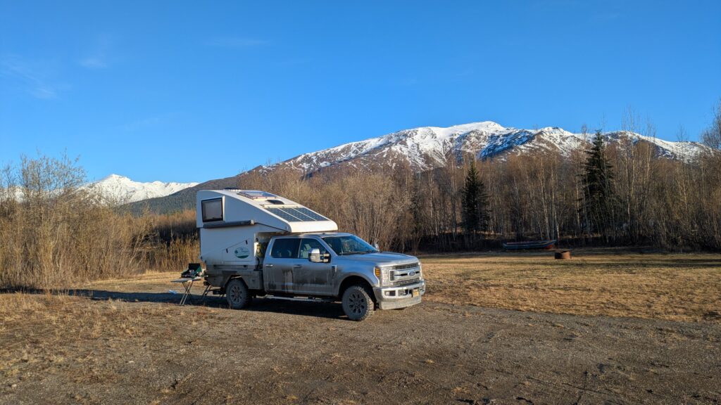
We headed north from our camp and began to enjoy the adventure of the road, following the pipeline, up and down the mountains, across the rivers and through the spruce forests. Tramp did all the hard work while his backside quickly became covered in thick muddy goo. The scenery was spectacular and eventually we hit the might Yukon River which historically has been the lifeblood of the people living in northern Alaska.
The Yukon River runs 1,900 miles (2,900 kilometres) from the Yukon to the Bering Sea and is the fifth largest river on the continent. It represented a major engineering hurdle for the pipeline but they built a bridge across it in 1975. We stopped to check out this iconic river and had lunch on it’s banks.

The mainly dirt and gravel road continued north, the weather constantly changing as the hours clicked by. We must have driven through six rainstorms, some of which made the road very sketchy, and from some of the high passes we could look down across the vastness of this land and see three different weather systems. Slushy snow/rain hit our windscreen on a couple of occasions and at other times we were basked in glorious sunshine. It was amazing.
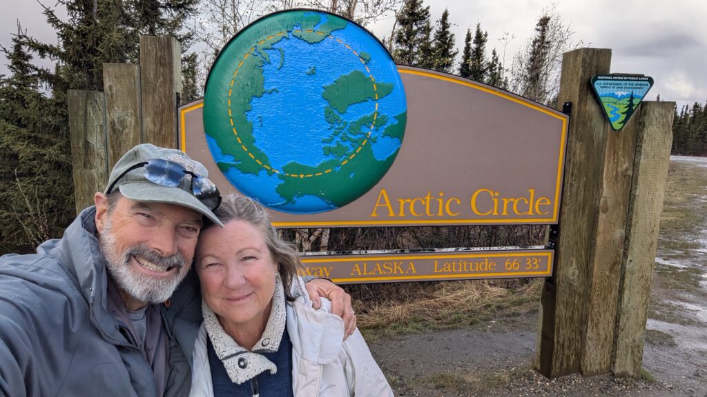
At one point we crossed the imaginary line of the map of 66°33’ N which is the Arctic Circle. Of course we had to jump out and celebrate the moment with a selfie and a hug because it was a milestone moment on our trip and a cool thing to do.
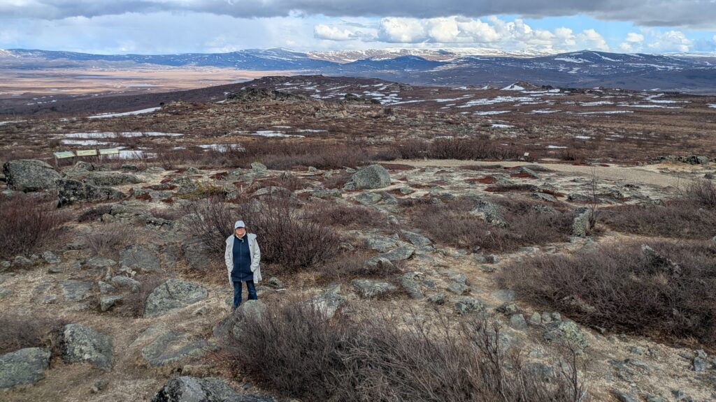
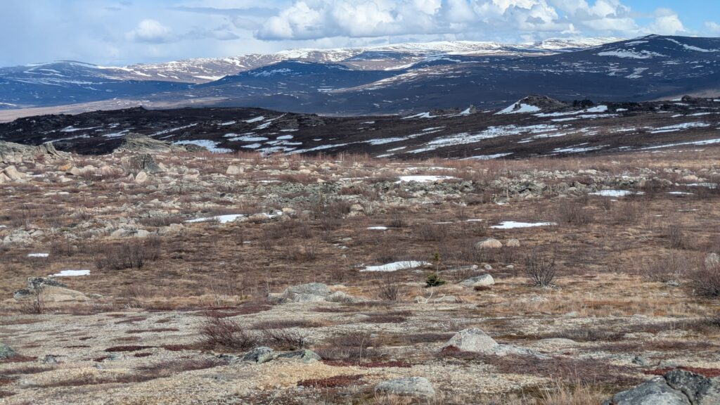
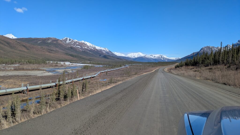
At Fingers Rock, a volcanic intrusion rising above the Arctic plains, we soaked in stunning views for just about as far as you’d care to see. And all along we followed the pipeline, usually above ground on it’s stilts but sometimes disappearing for sections as it snaked it’s way underground, depending on the soil composition, terrain and permafrost levels. By the end of the day it was almost like an old friend, always there, keeping us company, happy to pose for yet another photo.
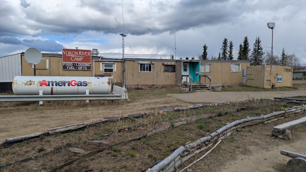
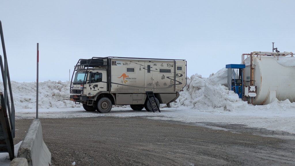
The halfway point of the Dalton Highway between Fairbanks and Prudhoe Bay is a truckers’ overnight stop and refuelling station called Coldfoot. We pulled in there for fuel (US$7.49 a gallon or A$2.75 a litre) and ended up camping by a small lake opposite the truck stop, even enjoying a beer in the self-proclaimed ‘most northerly saloon in North America’. It had been a fabulous day but we were only halfway there.
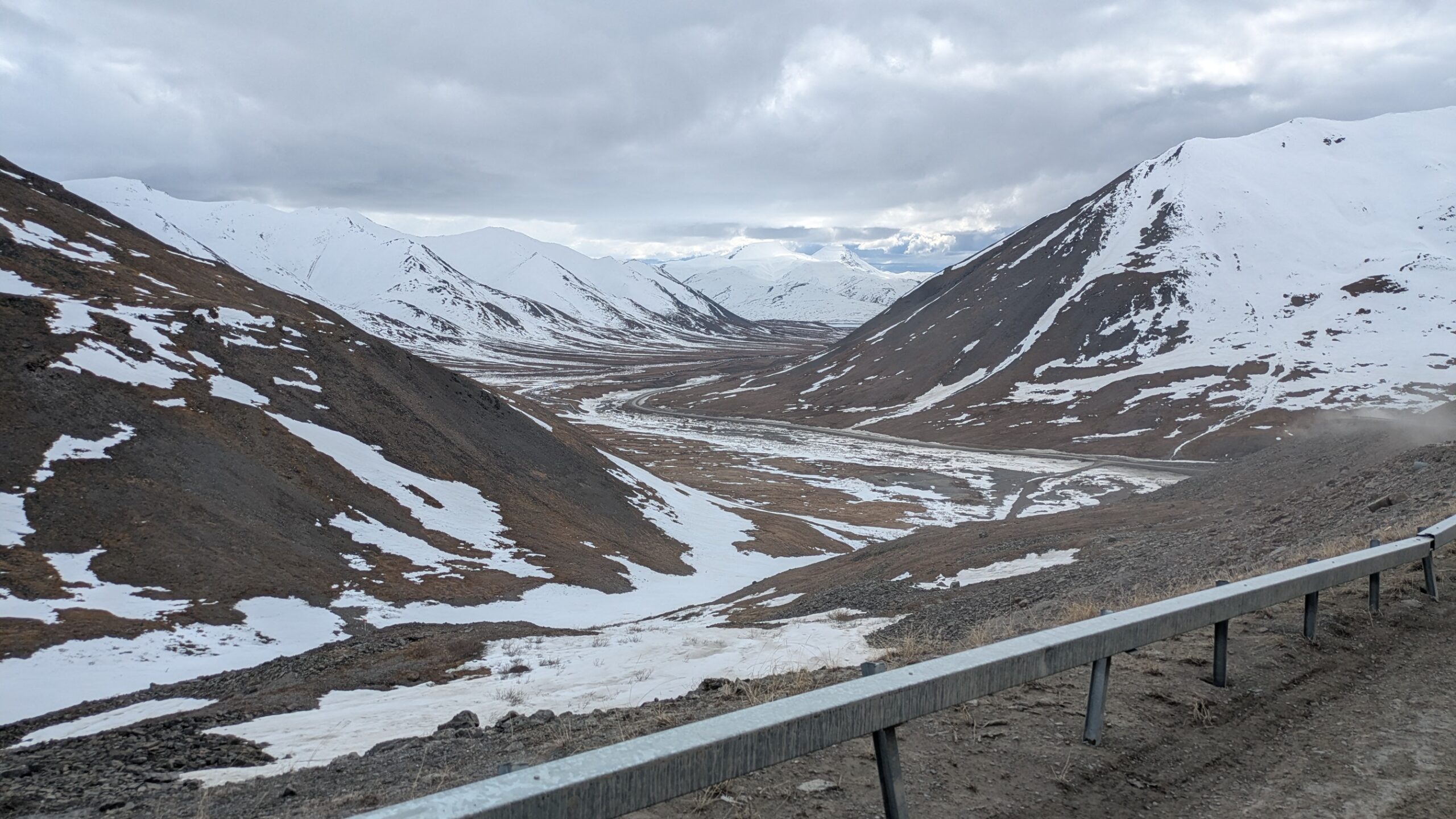
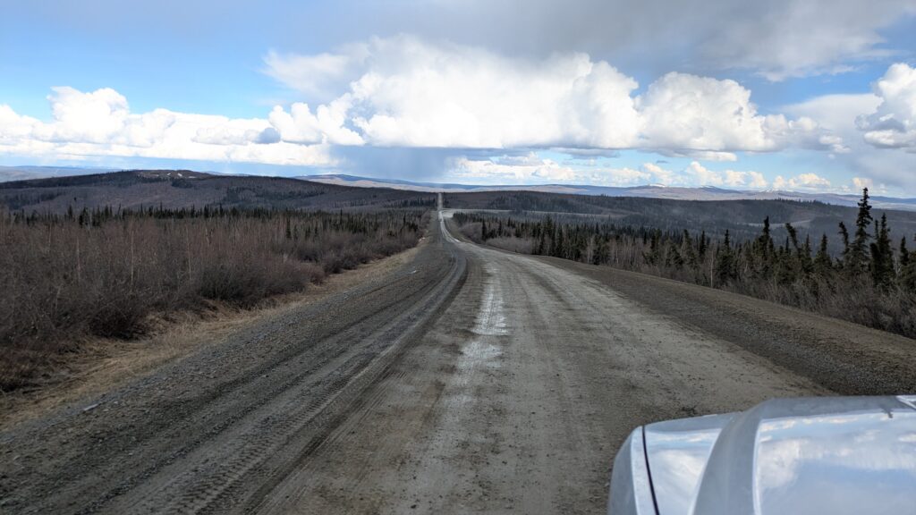
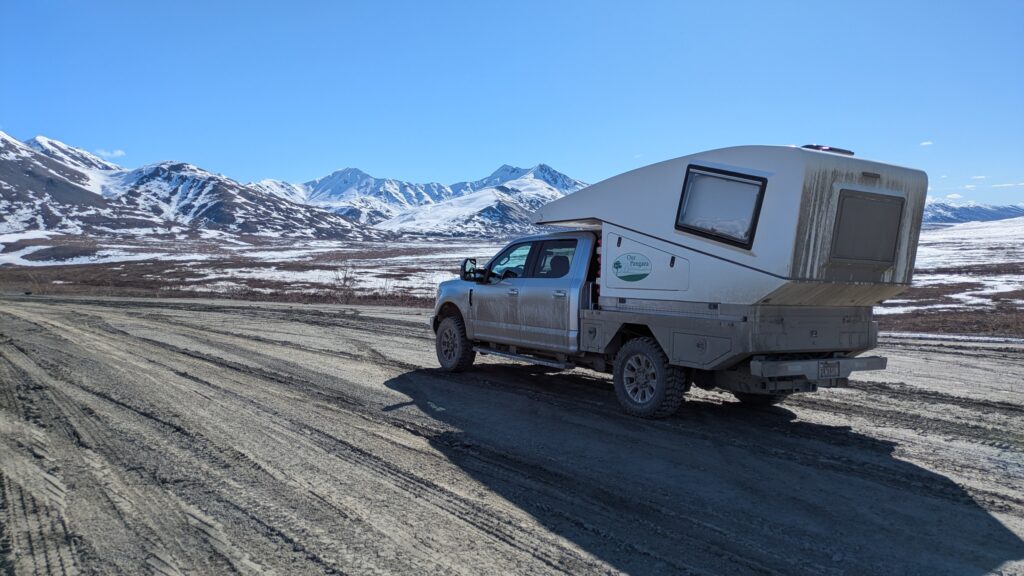
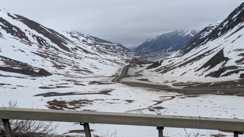
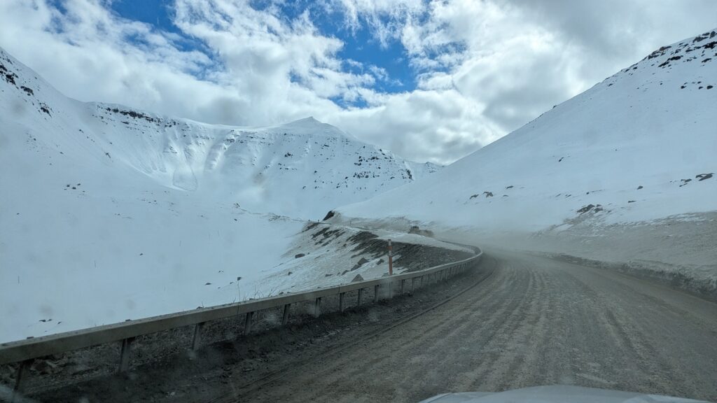
The second day of the drive to the Arctic Ocean involves climbing over the majestic Brooks Range of mountains, crossing wild open tundra, dealing with ever-changing weather and a rough road that can break parts and hearts. And all of this over a 240 mile (390 km) drive from Coldfoot to Prudhoe Bay.
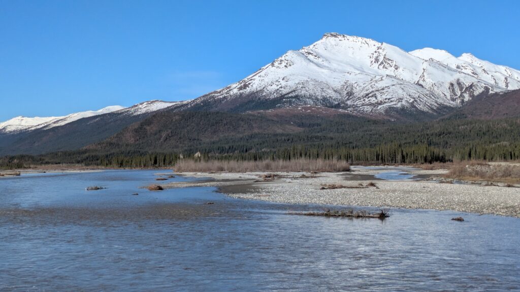
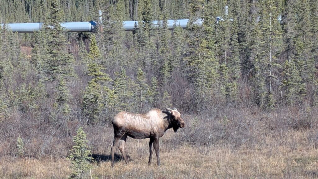
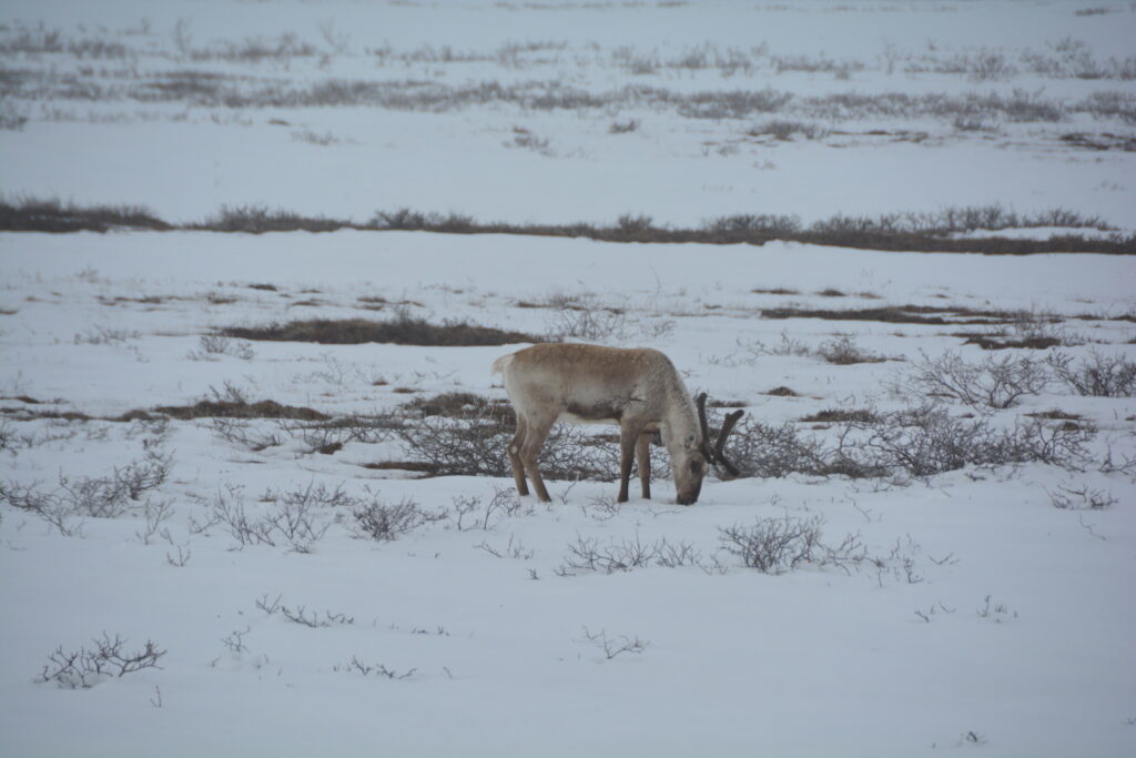
We started well with beautiful blue skies and stunning views of the snowcapped mountains all around us while the pipeline rode shotgun next to us. There was always a braided river not far from us and the snow patches became bigger and more frequent as we climbed. We saw a moose and a couple small herds of caribou.
We came to the top of a steep rise and entered a fairy tale world of mountains, snow and running streams, just beautiful stuff, with temperatures hovering around freezing. And yet we climbed more, a couple of large sweeping switchbacks, now with snow over six feet (two metres) deep on the side of the road. This was stunning stuff.
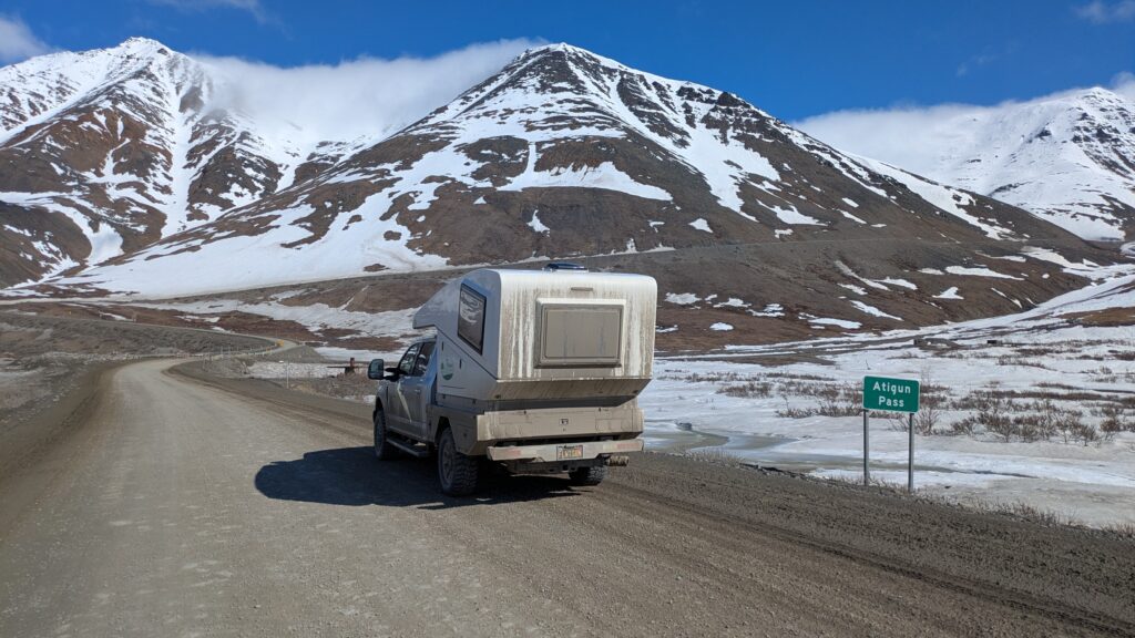
Finally we reached the top of Atigun Pass, at 4,739 feet (1,444 metres) the highest pass in Alaska kept open year-round. In doing so we crossed the Continental Divide and descended into a new world of snow and ice, mountains and tundra…and fog.
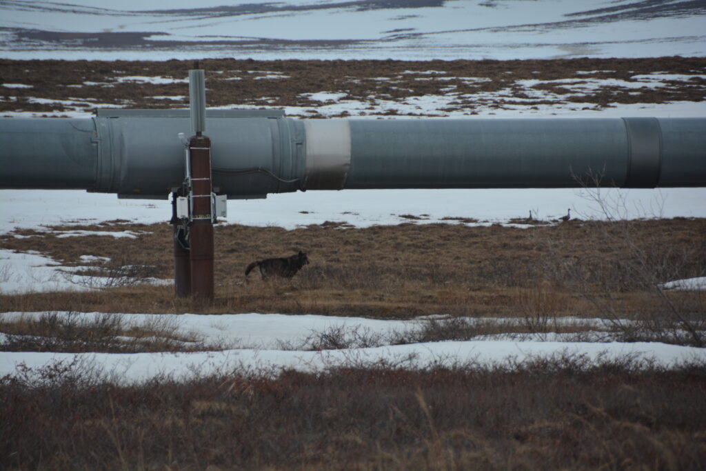
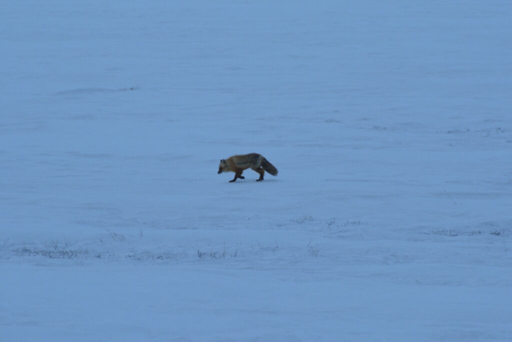
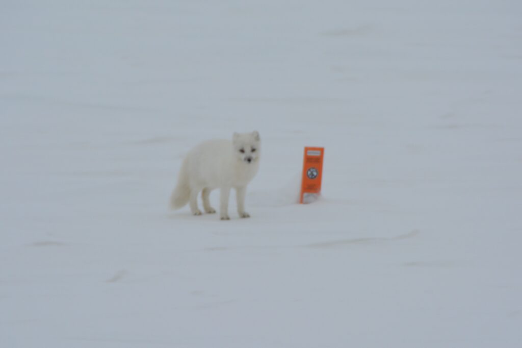
The fog plagued us for the next couple of hours but added to the wintery adventure. We saw more caribou, a handsome black wolf, an arctic fox and a much rarer red fox, and four muskoxen.
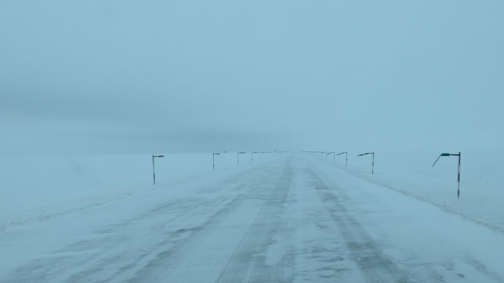
As we neared our destination the fog lifted a bit but the flat land with absolutely no visibility other than endless snowy white made it seem as if we were on an Antarctic ice shelf. Snow blew across the road and at one stage a huge snowplough nearly ploughed into us when we stopped to check out the muskoxen.
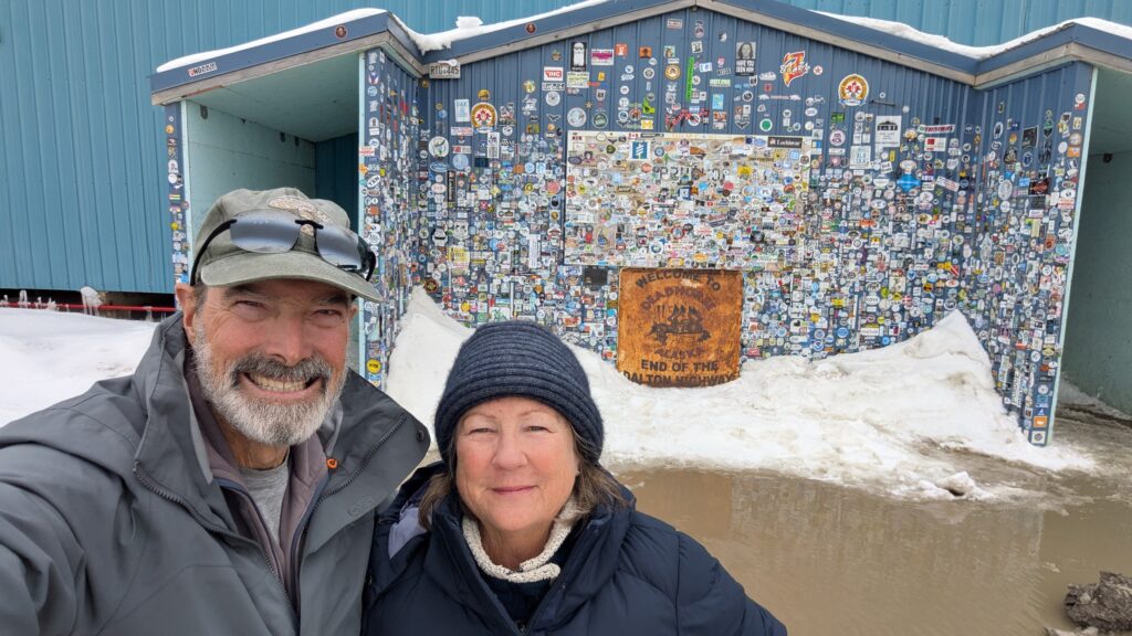
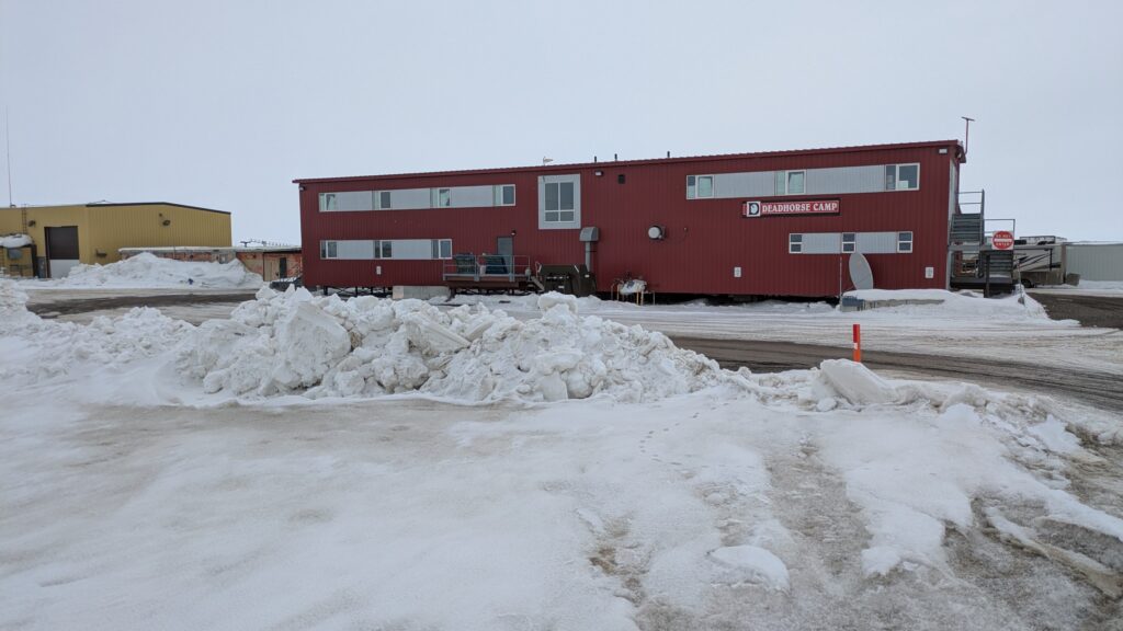
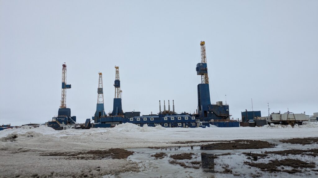
The Dalton Highway actually ends at the town of Deadhorse (after town names of Yellowknife, North Pole and Coldfoot there had to be a Deadhorse) which is on the shores of Prudhoe Bay. Deadhorse is said to have no permanent population but up to 3,000 workers and contractors live there temporarily on long shifts as part of the massive Arctic Ocean oilfields operations. They pump the oil, which is mixed with other chemicals and water, from the nearby sites, separate it and then send it through the pipeline all the way to the southern port town of Valdez.
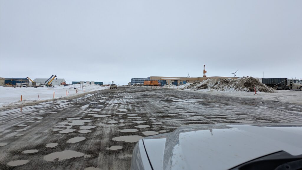
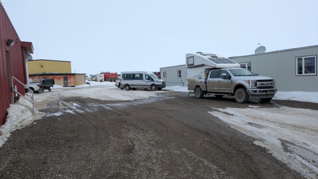
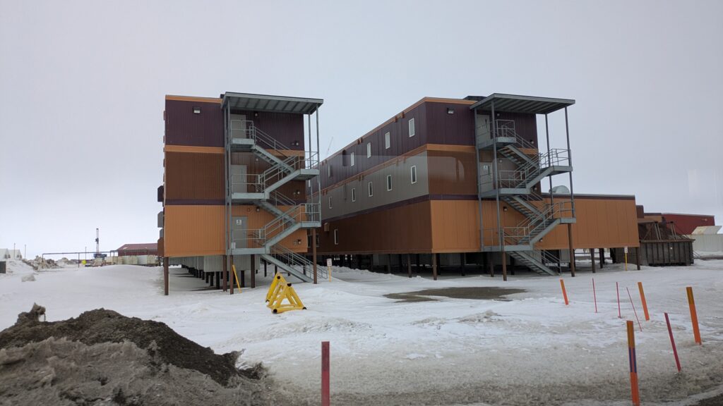
The town, if you call it that, was still frozen from the winter, snow piled up, a cold wind and the few roads lined with heavy machinery equipment, office and work complexes and large ‘hotel’ complexes which house and feed the workers. This is truly the northern edge of where mankind can live, cold, harsh and extremely remote. The temperature was below freezing and dropping. You couldn’t pay me enough.
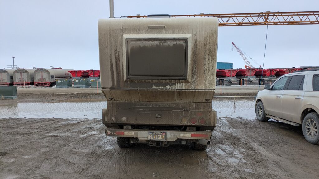
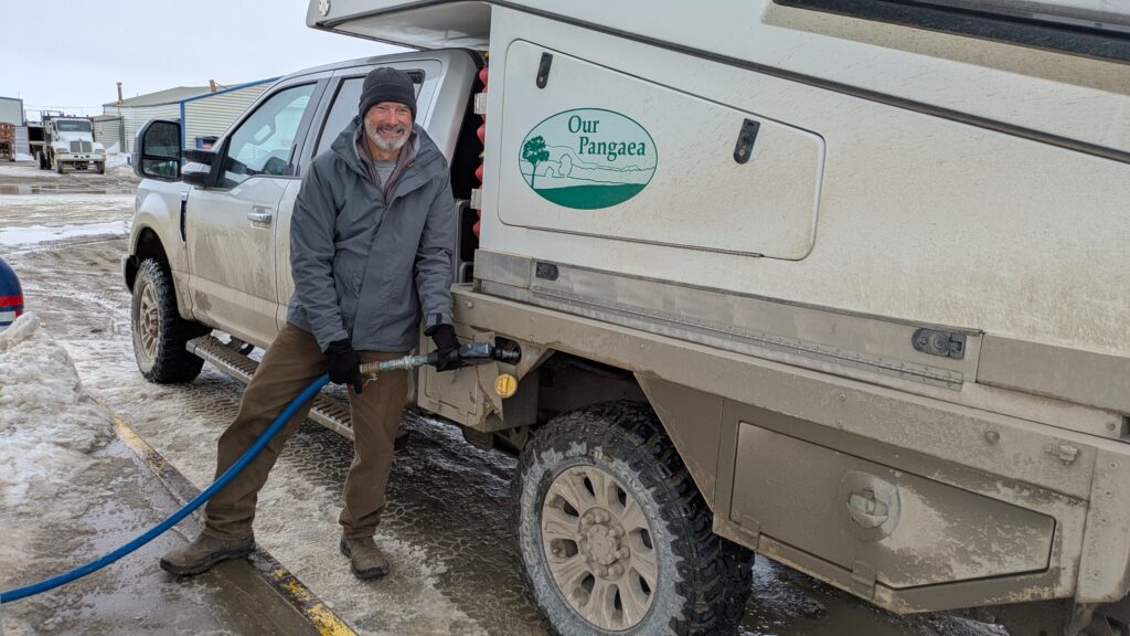
We pulled in behind one of these workers hotels, more a fancy bunkhouse, and asked permission to park behind it for the night. By parking in behind two buildings we could stay out of the wind and cozy-up for the night. Because the next day we had a special tour booked. And because we were in the land of the midnight sun we shuttered everything up and conked out for another bright and sunny cozy sub-zero night.
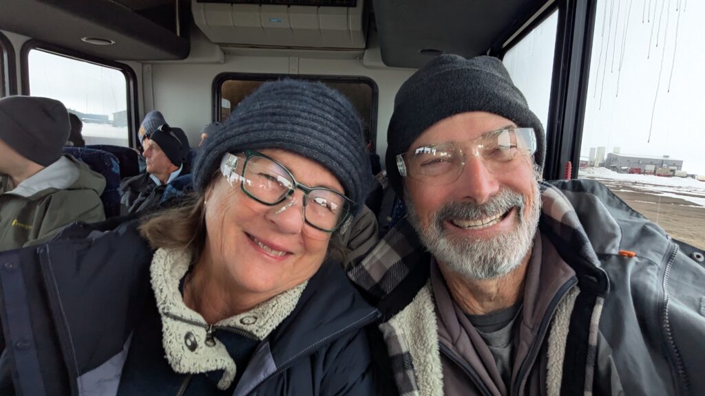
The area between Deadhorse and Prudhoe Bay, only about three miles, is a high security area because that’s where all the drilling and other stuff is happening. We woke to -2°C (29°F), everything frozen, including our water pump and our stairs which had been sitting in soft mud and slush. We jumped on a bus run by a local tour company and headed out through the security gate to the Arctic Ocean. It was the first tour they had run for the season.
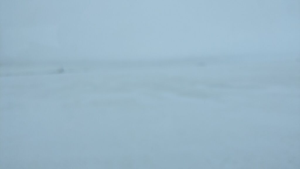
At this time of year everything is covered in snow and ice, including the ocean. Wind was blowing across the flat surface and made everyone slightly miserable. Never mind, Julie and I took some tentative steps at first, stepping out onto the frozen ocean and then boldly walked further out, stumbling through drifts of snow, laughing our heads off and absolutely loving it.
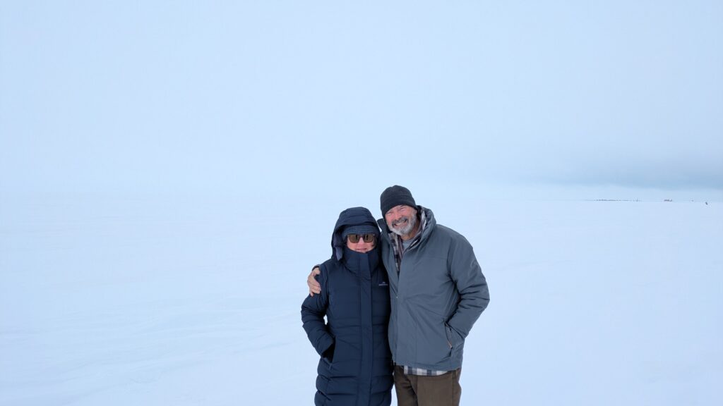
We had done the same thing nine years ago but in August and had taken off our shoes and waded into the water. Today that was completely impossible. So we can now claim we’ve stood IN the Arctic Ocean and stood ON the Arctic Ocean.
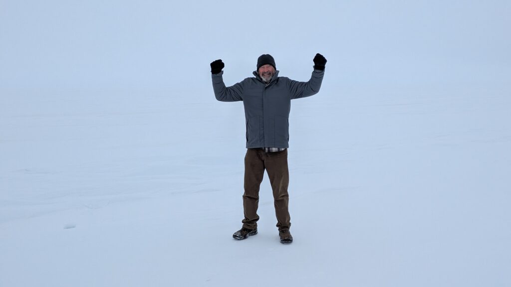
And here’s a fun fact – we had reached a latitude of 70.23°N, the second highest we had ever been (Nordcap on the northern tip of Norway is 71.16°N).
Back at Tramp we had some trouble getting his top down because it was also frozen but eventually hit the road, heading back south. Because if you’re leaving Deadhorse there’s only one road out and it’s going straight south.
Except the wind was still whipping across the frozen tundra, blowing snow onto the road and creating an almost total whiteout. The driver had some challenging times for the first 50 miles or so until we cleared that offshore wind.
The sun came out and we had an absolutely glorious afternoon drive back down the Dalton Highway, clear as far as we could see and the beautiful Brooks Range of mountains getting ever closer. We saw caribou and the four musk oxen again but sadly they hadn’t moved closer to the road and were still out of Nikon range.
After a joyous couple of hours we passed up and over the Atigun Pass again and down the other side, leaving the tundra and re-entering the trees, eventually camping by Marion Creek with snow-capped mountains all around us. We weren’t finished with the Dalton Highway but we’d already had one of the most exceptional travel experiences of all time.
Comments
The Alaska Pipeline — No Comments
HTML tags allowed in your comment: <a href="" title=""> <abbr title=""> <acronym title=""> <b> <blockquote cite=""> <cite> <code> <del datetime=""> <em> <i> <q cite=""> <s> <strike> <strong>