The Western Arthur Traverse
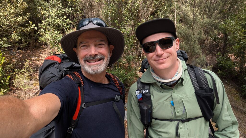
Tasmania is unquestionably the adventure playground headquarters for outdoor enthusiasts in Australia. With vast swathes of the island preserved by national parks and world heritage protected wilderness areas there are almost unlimited opportunities to explore places very few people venture into. And after three previous trips to Tasmania to do multi-day walks there was still one trip – the biggest and baddest of them all – that I just had to do. So when our youngest son Zach suggested the same thing, that was it. We were off to do the Western Arthur Traverse.
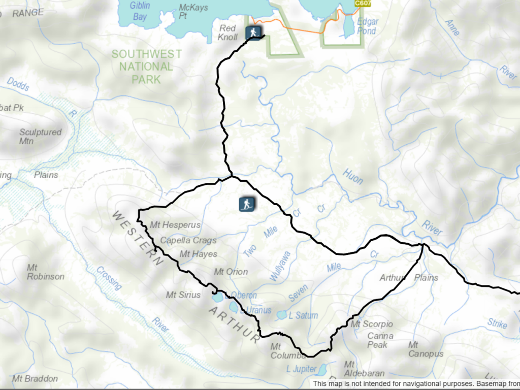
The Western Arthur Traverse, or WAT, looks fairly mundane at first glance. It is what’s called a lollipop route, meaning the first and last days are the same while the middle days are a loop trail that ascends the Western Arthur Range of mountains along what is called the Alpha Moraine, follows the ridgeline, more or less, and then comes off the range on the Kappa Moraine. It is only 66 kilometres long and yet can take anywhere from five to eight days to complete.
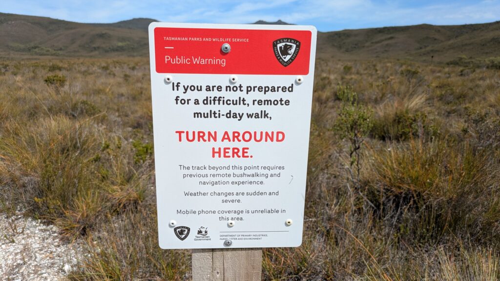
But closer inspection tells the real story. Listed by TasParks as a Grade 5 walk (Very experienced bushwalkers with specialised skills, including navigation and emergency first aid. Tracks are likely to be very rough, very steep and unmarked. This walk is for physically capable and highly experienced walkers who are confident with navigation, cliffs and rock scrambling, pack hauling and extreme weather.)
And when it comes to walking in Tasmania you quickly learn that the weather – the extreme weather – is the boss. Everything, including your safety, is impacted by the ever-changing weather. In January 2024 alone they rescued 12 people off this range.
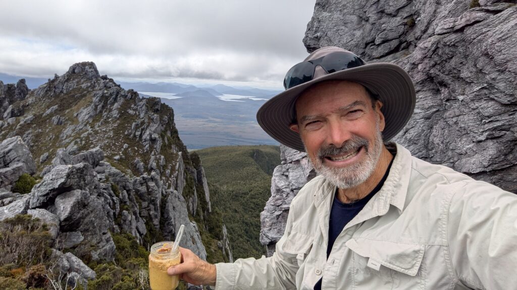
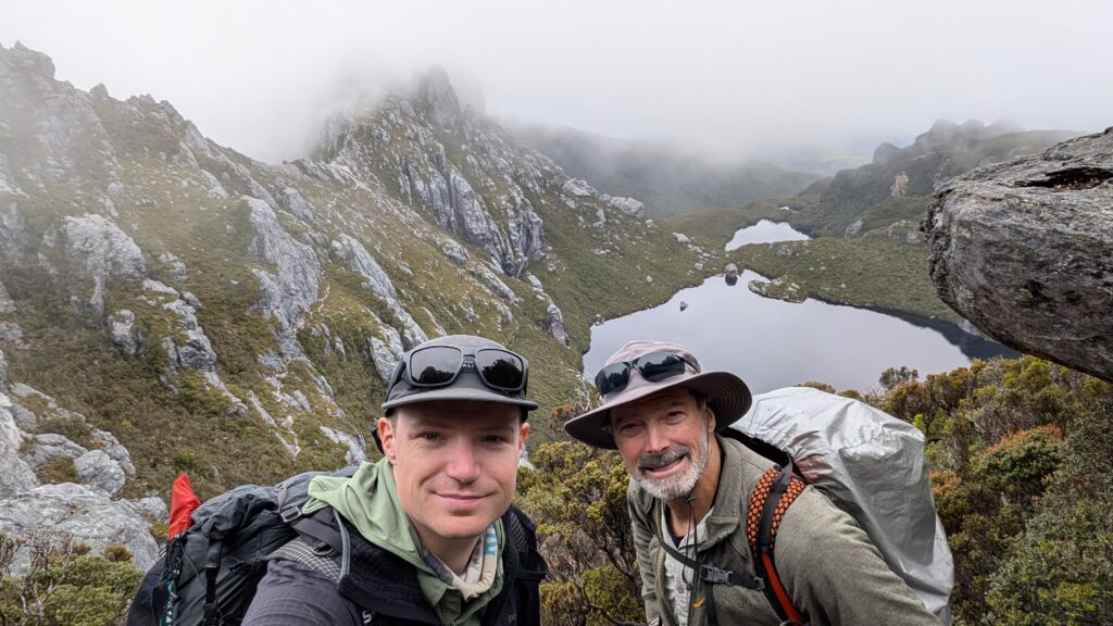
Never mind, we were ready. We were led by Zach, our super-hiker, and we were forever slowed down by me, the old man. But we made a great team, supporting each other whenever it was necessary, and I can’t begin to say what great fun it was to have this adventure with him.
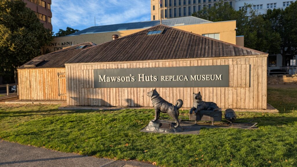
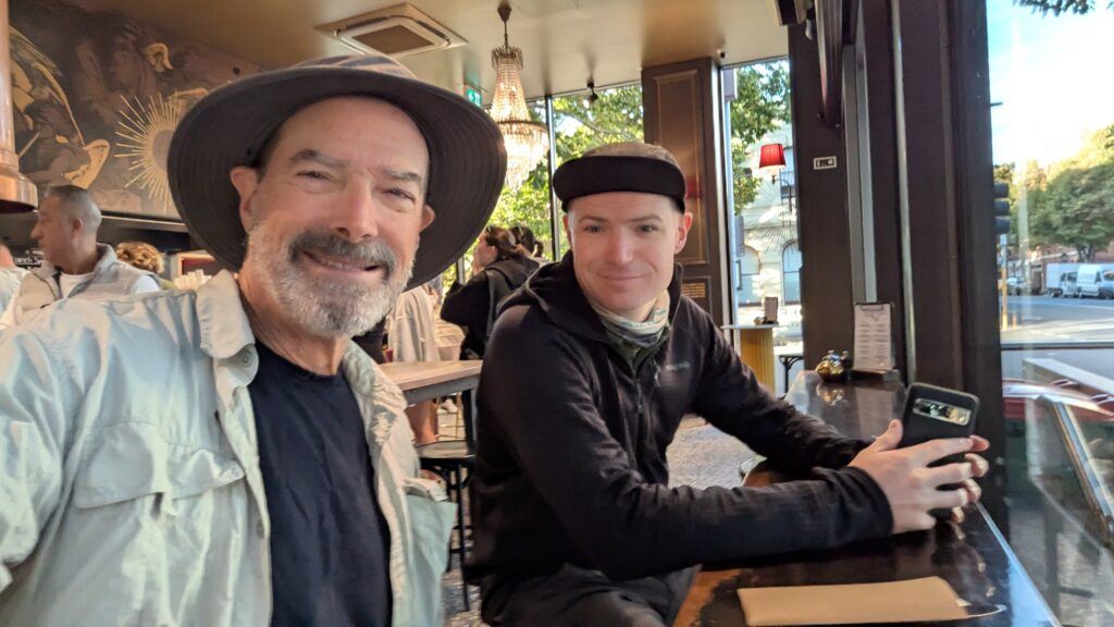
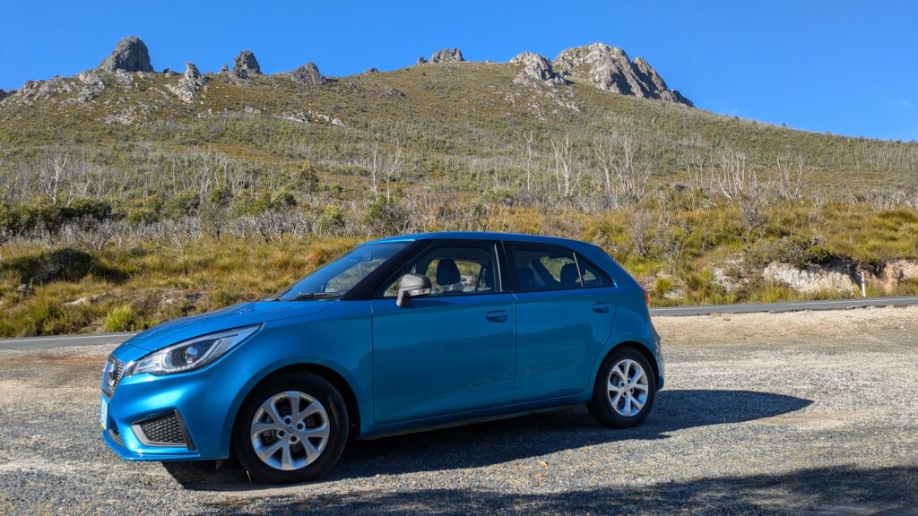
We flew into Hobart and spent a night in this very liveable little city before taking our hire car about 100 kilometres, the last third on dirt road, to the trailhead at Houn Campground, near Scotts Peak Dam. From there we hoisted our 17 kg packs, heavy with eight days of food, three litres of water and the bare minimum of everything else, and headed into the wilderness.
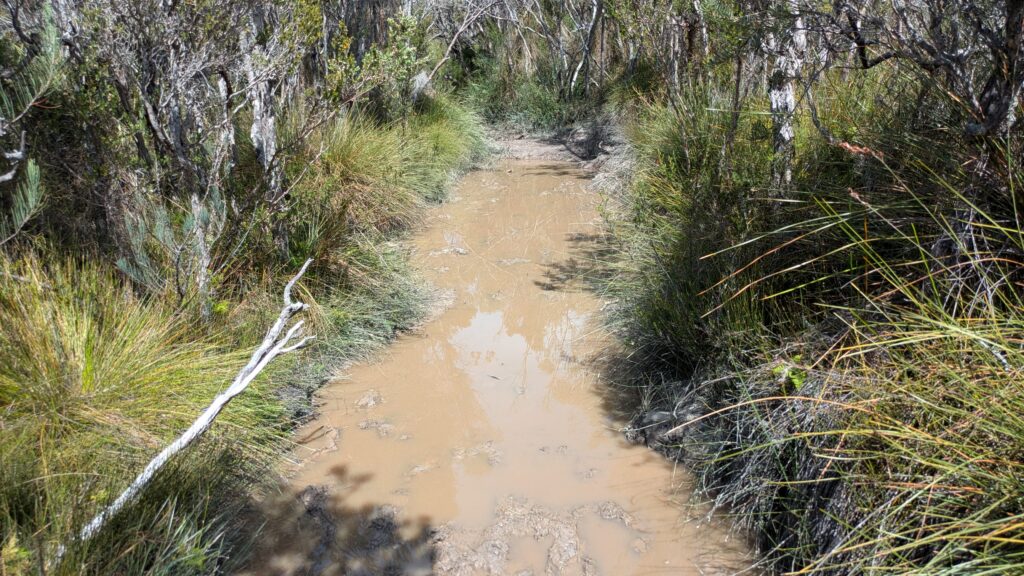
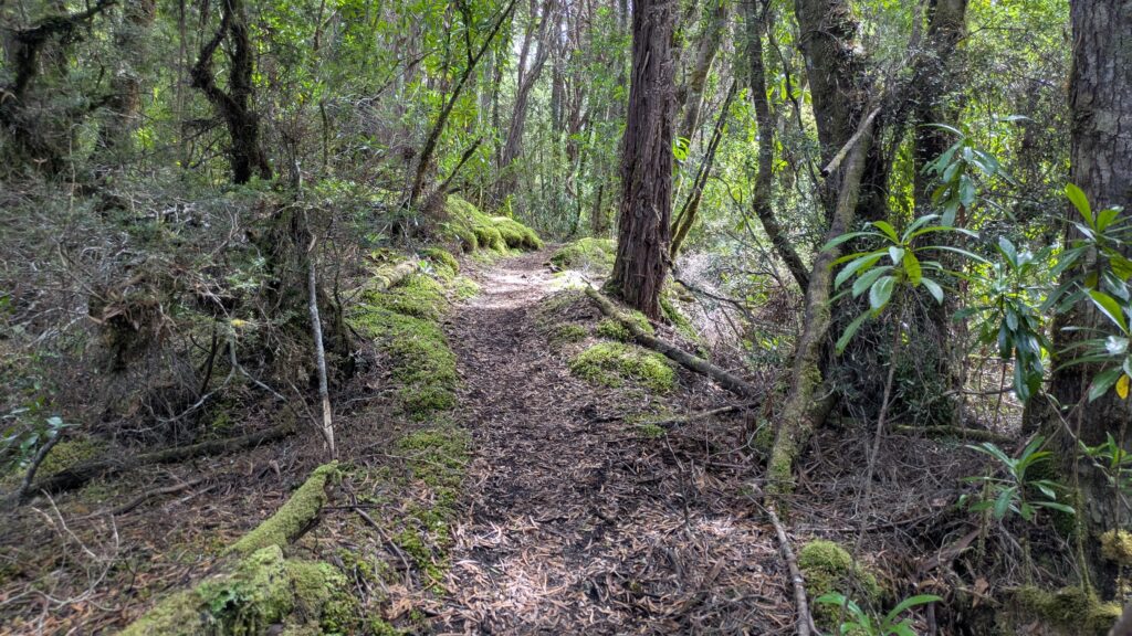
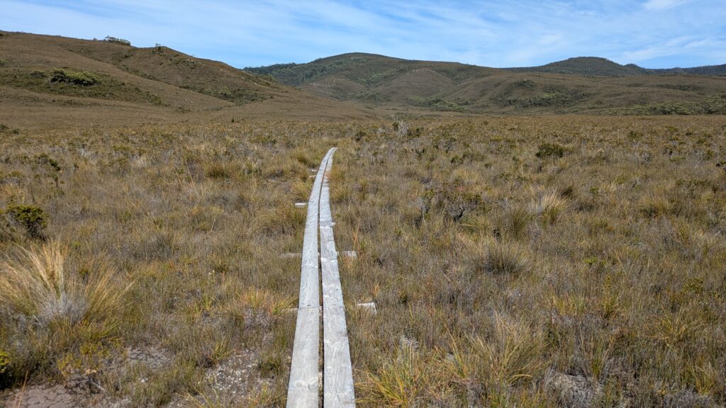
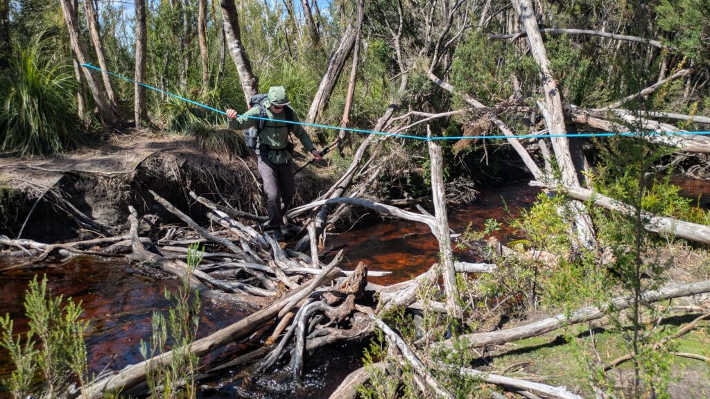
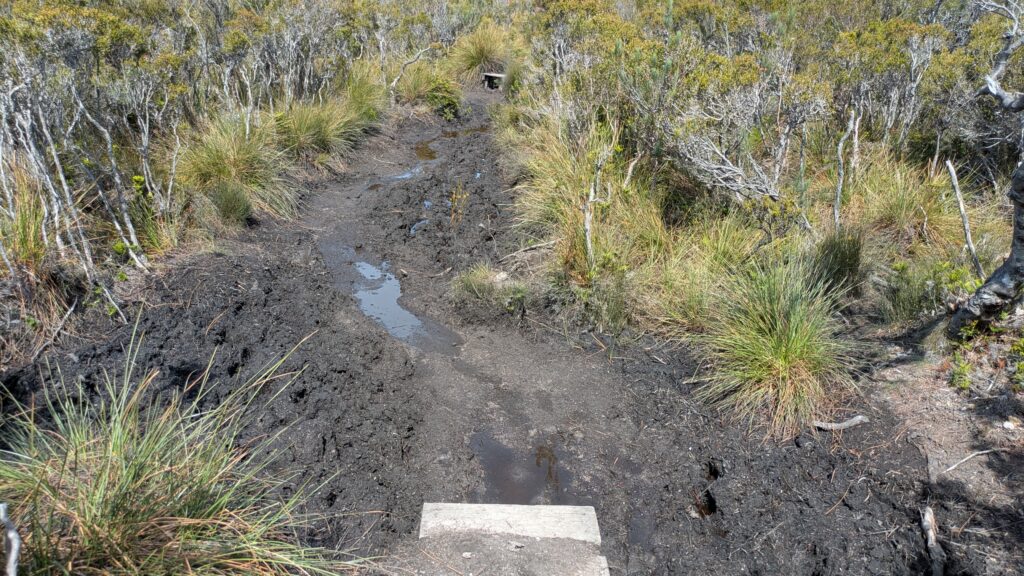
The first day’s walk to Junction Creek campsite was a relatively flat-ish nine kilometre track across open button grass plains with long muddy sections and through thick trees that line the creeks we crossed. Along the way we met a few walkers who were returning from the mountains or had decided to turn around, warning us of the impending bad weather. “Don’t underestimate Tasmanian weather” one harried hiker told us. We knew the forecast was for bad weather over the next couple of days before it improved but we didn’t expect experienced hikers to turn around. What had we gotten ourselves into?
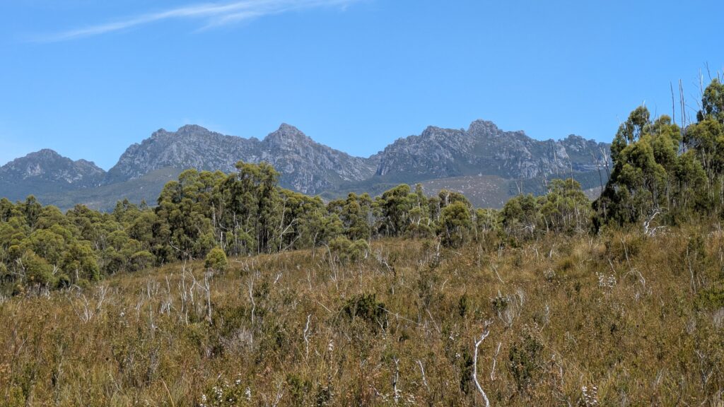
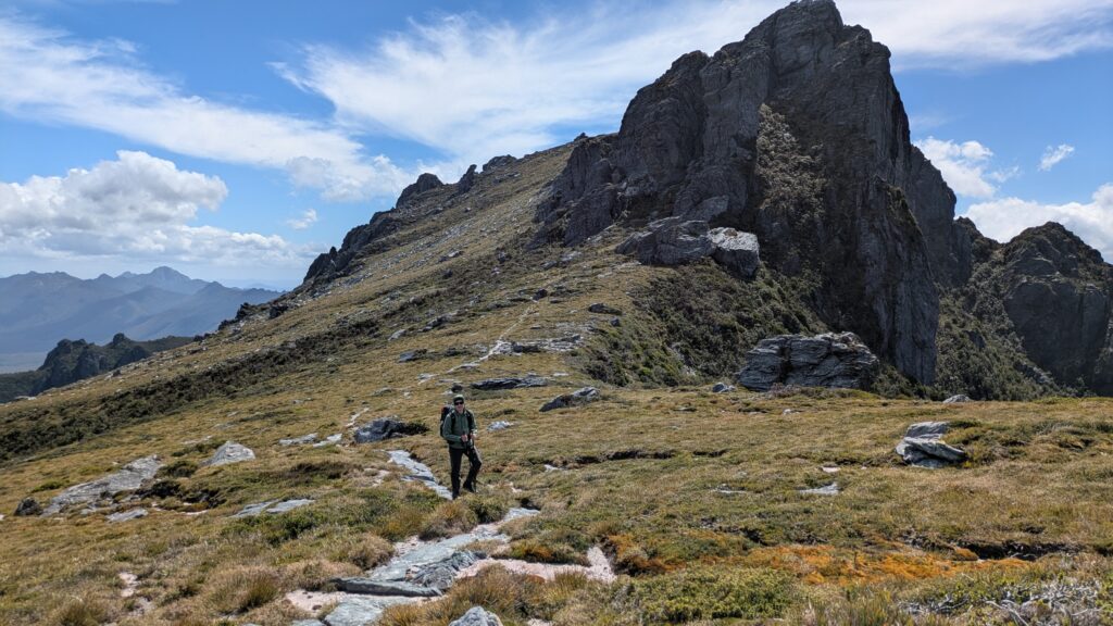
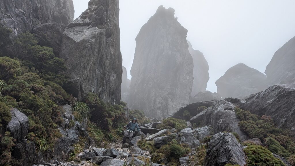
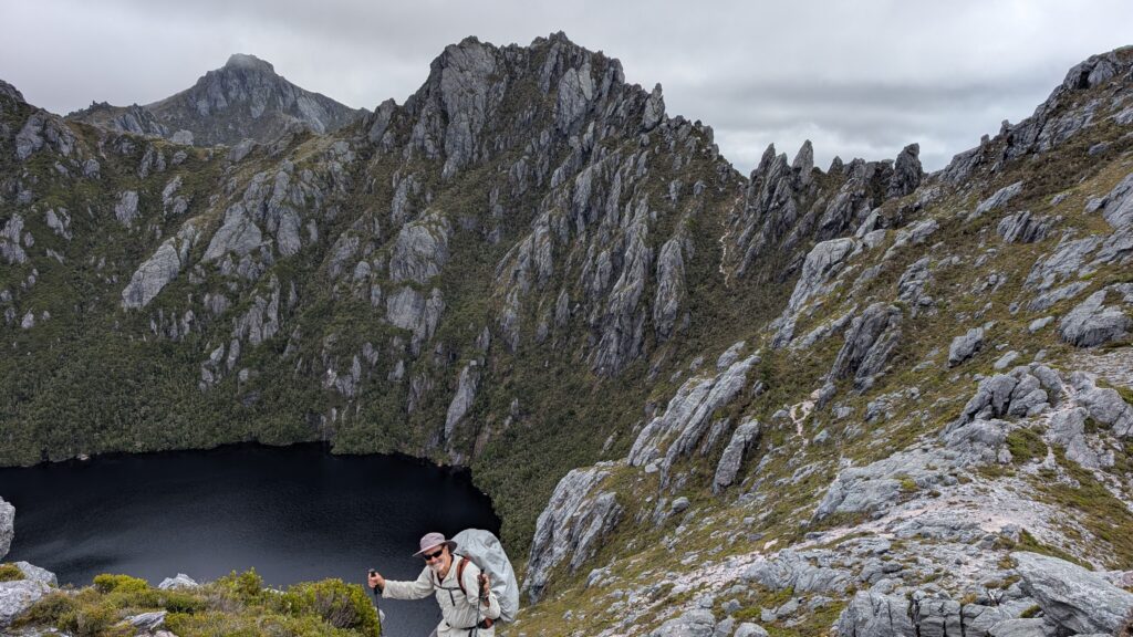
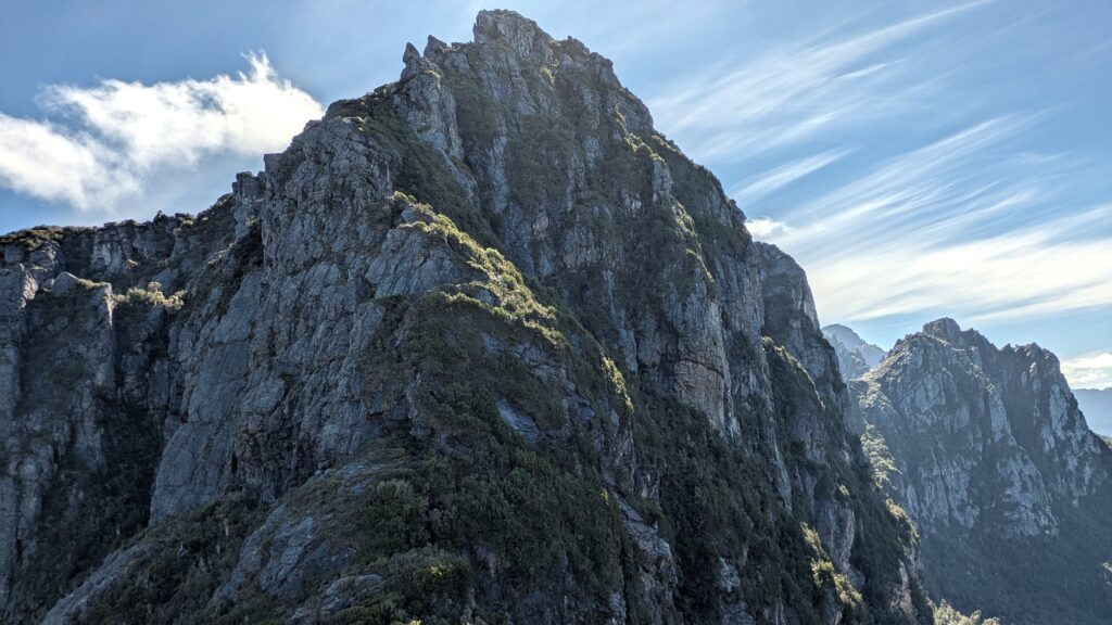
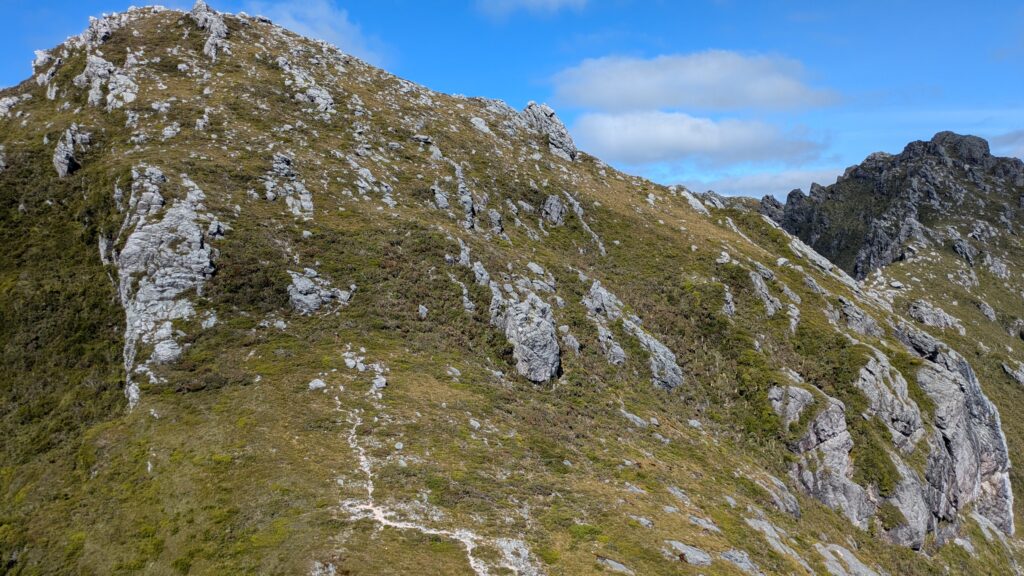
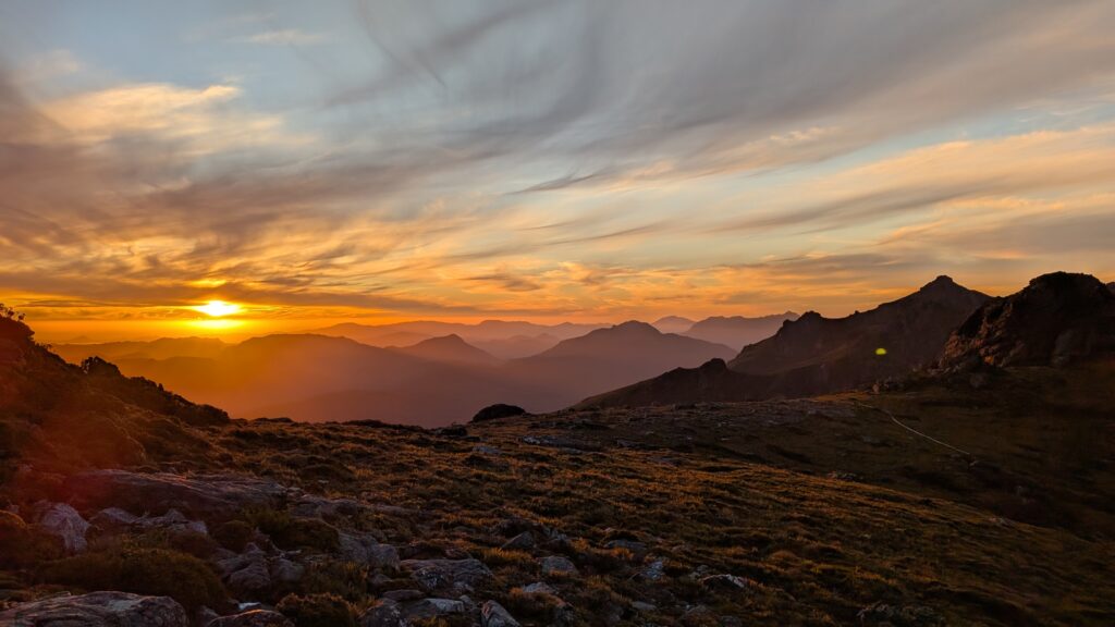
The next day we started off on one of the toughest days of the trip – a total of 1,100 metres of elevation gain to reach the top of the Western Arthur Range. Under threatening skies we started the long climb up the Alpha Moraine, a steep trail without the niceties of switchbacks or formed steps. Rain came and went while the views of the Arthur Plains below us became more spectacular as we climbed.
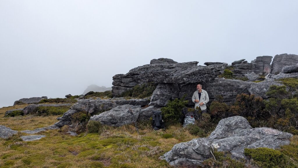
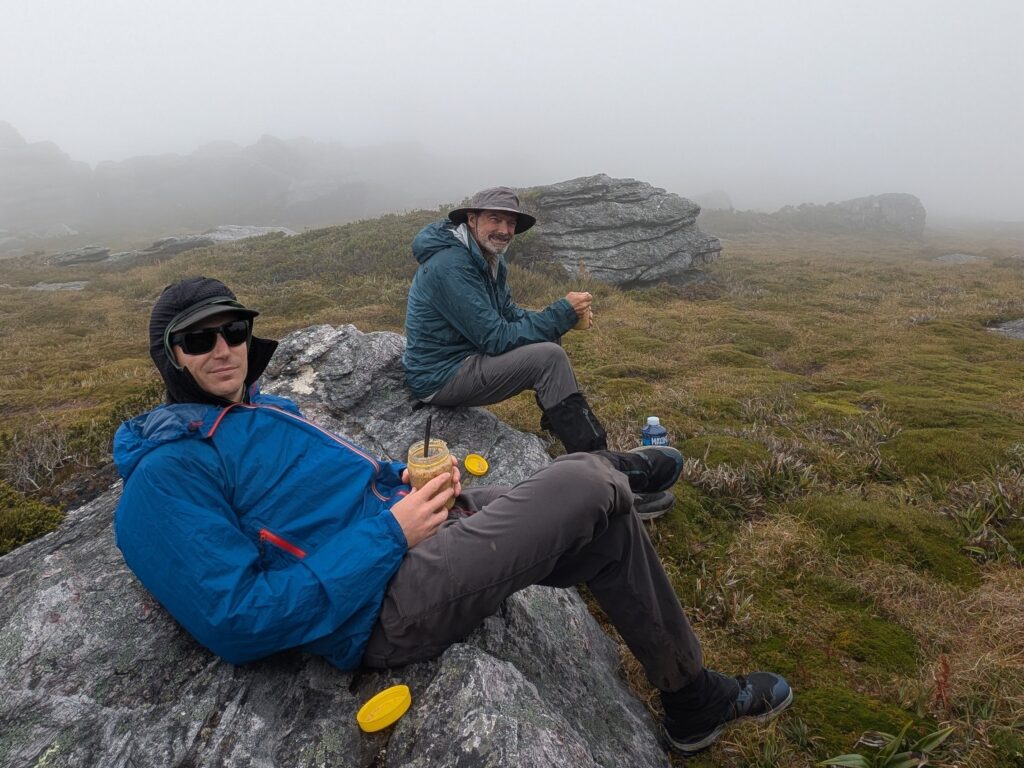
Eventually we made the top to a blustery wind, some rain, thick cloud and even hail. Zach and I took cover behind a large rock, dropped our packs and had lunch while we caught our breath and took in the scene around us. We were on top of the Western Arthur Range and it was glorious!
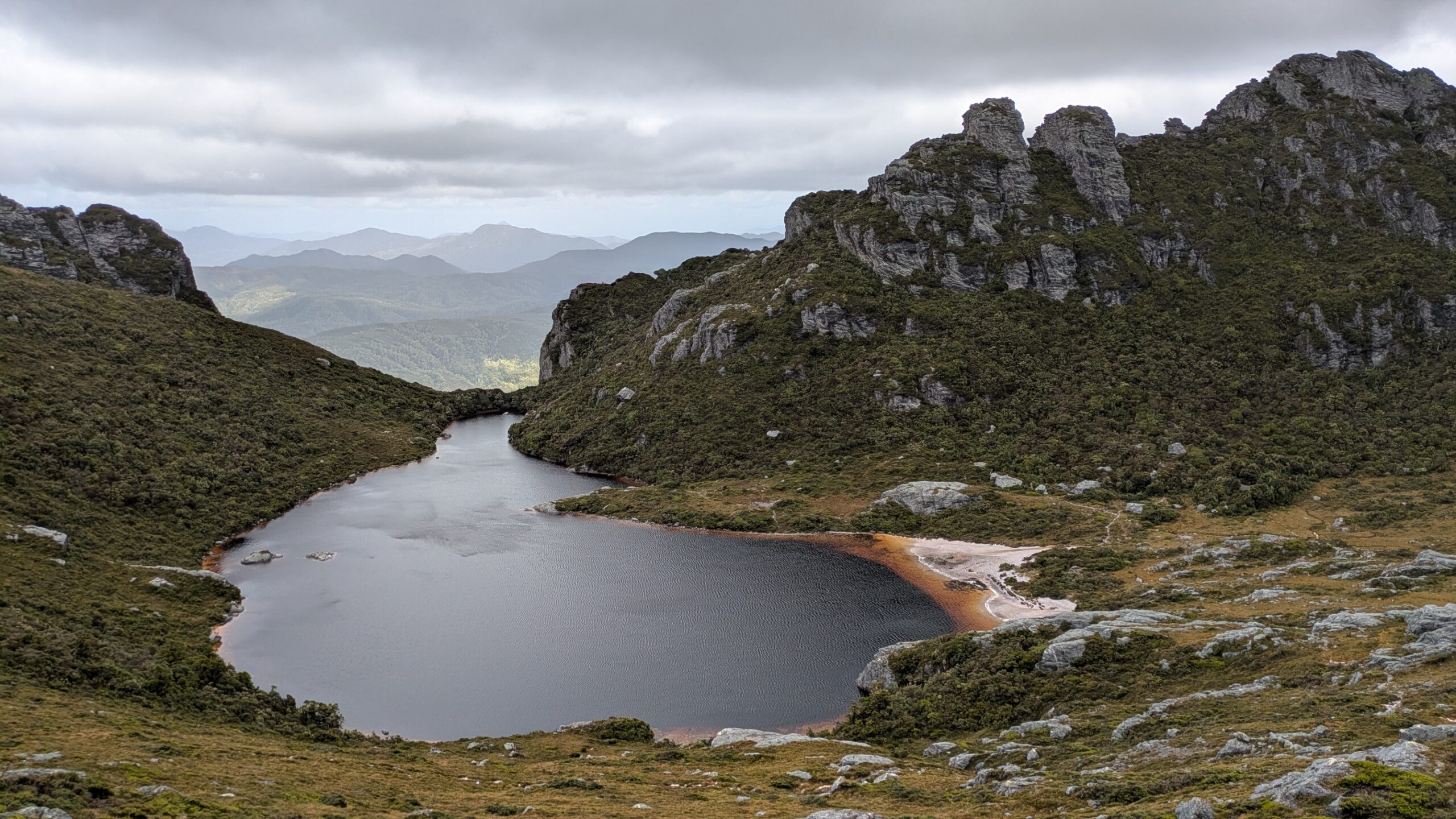
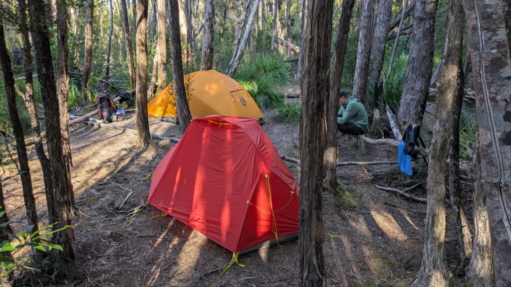
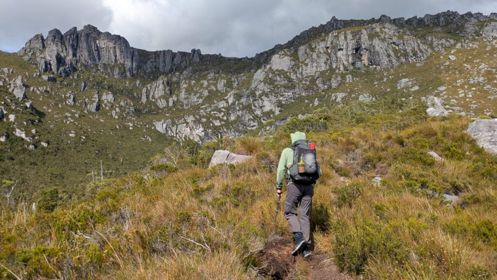
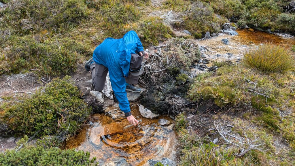
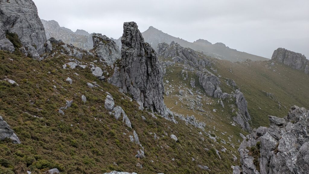
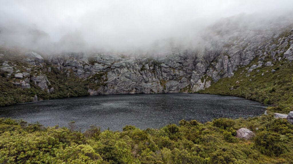
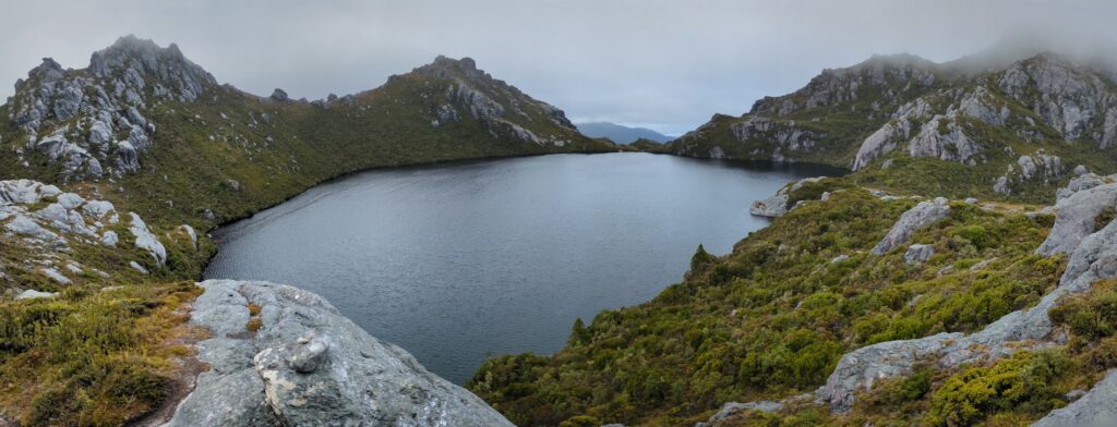
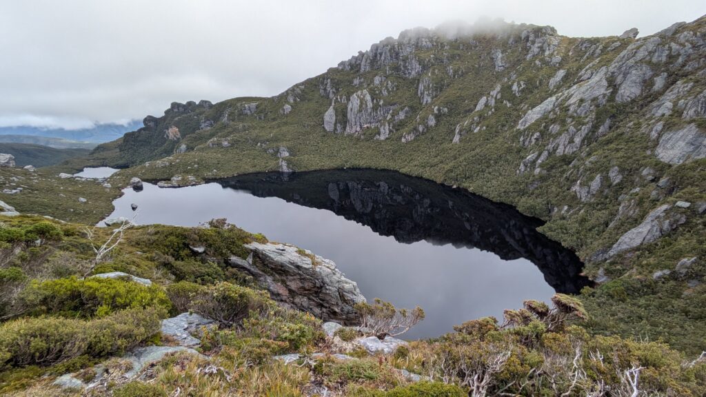
We followed the trail for a couple of hours as it traversed the jagged ridgeline of the mountains, the weather constantly changing, until we came to a saddle and looked down on beautiful Lake Cygnus, our camp for the night. These glacier-carved mountains are famous for it’s long string of alpine lakes and most campsites are on these lakes due to the availability of water and some protection from the incessant wind.
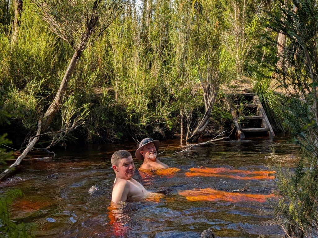
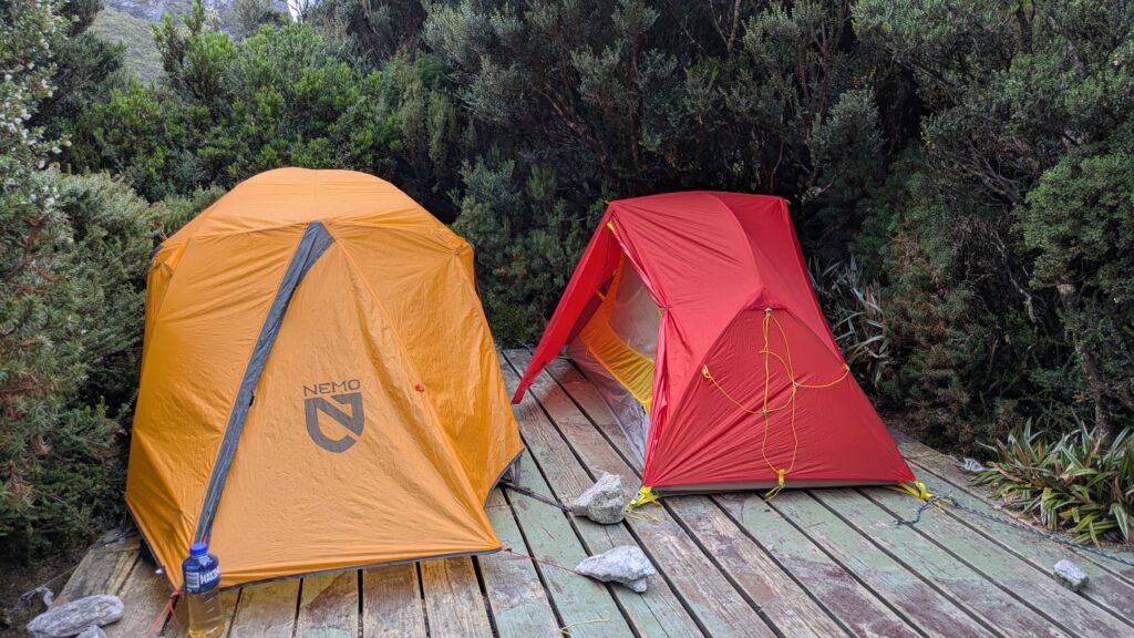
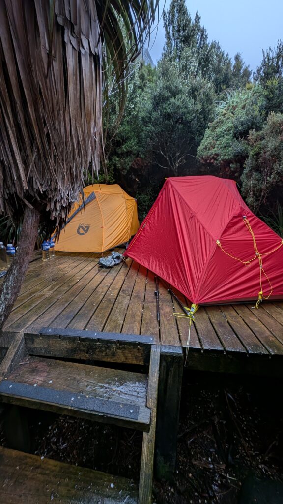
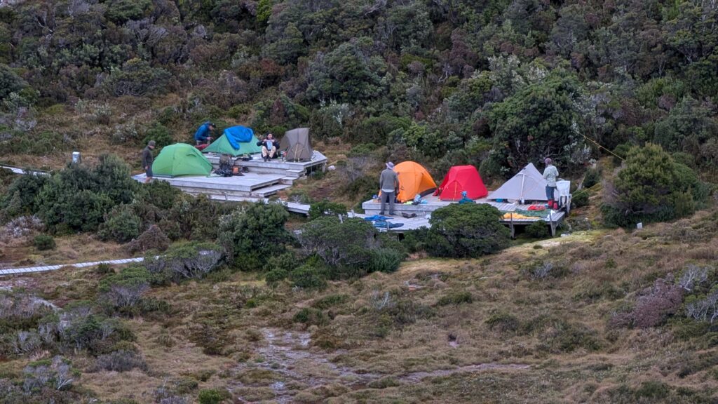
We set up our tents on one of the wooden platforms sheltering amongst the trees, filled our bottles and explored the lake’s edge. The mountain walls rose up all around us and the setting was just outstanding. This is what we came for.
The clouds and rain soon set in so we retreated to the warmth of our tent. The next day’s walk was reported to be only four kilometres so in the morning when it was drizzling and the clouds were still sitting on top of us we decided to wait awhile for better conditions. By around midday, after waiting a long 22 hours in our tents, we packed up and hit the trail just as the clouds cleared and we could see the mountains around us. Our timing was perfect…for a while.
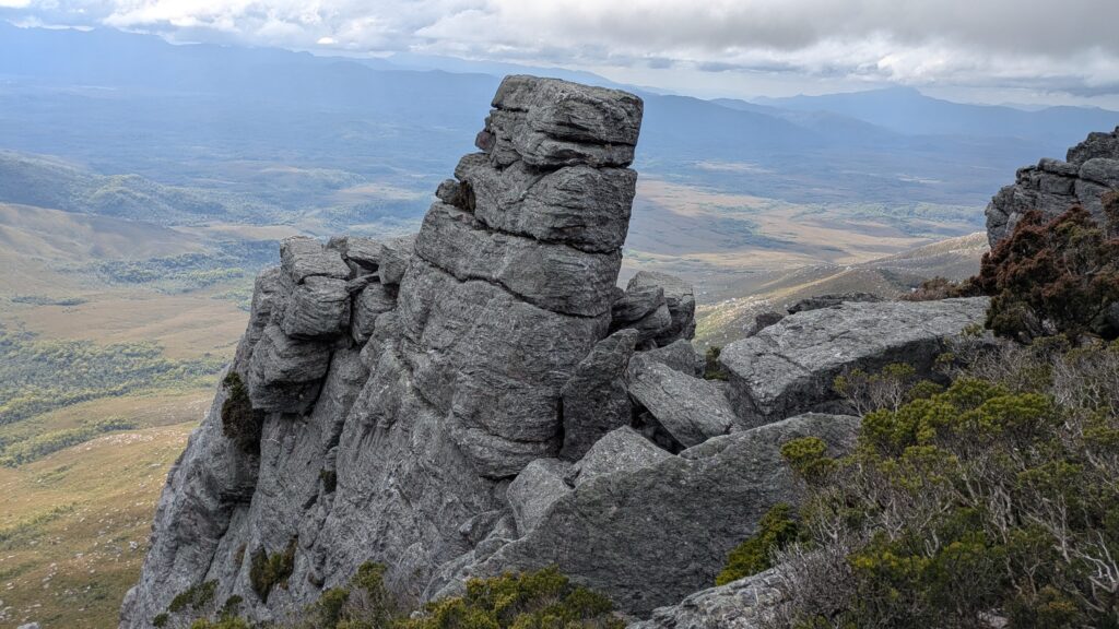
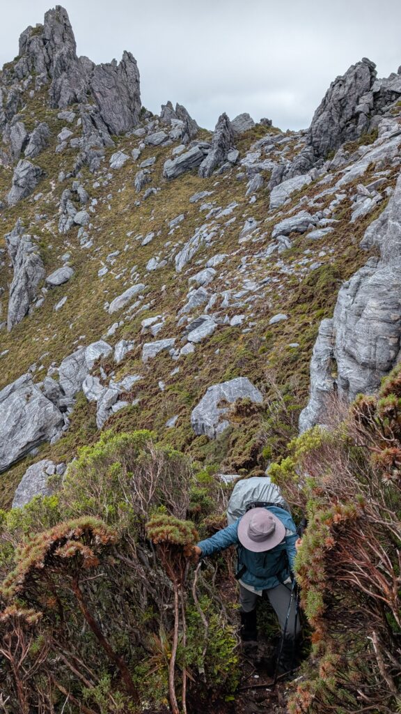
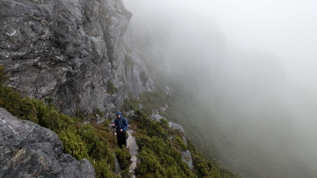
We climbed out of the cirque of mountains that surrounded Lake Cygnus, gasping in awe of the views all around us. We continued eastward until the weather closed in again and the wind picked up. We donned full rain gear and kept our head low as the wind knocked us around and the views disappeared. A familiar pattern emerged as we would drop straight down a chute to the ridge below and then immediately have to climb back up to the next ridge. It was spectacular, gruelling and at times very sketchy.
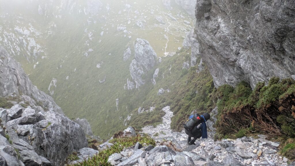
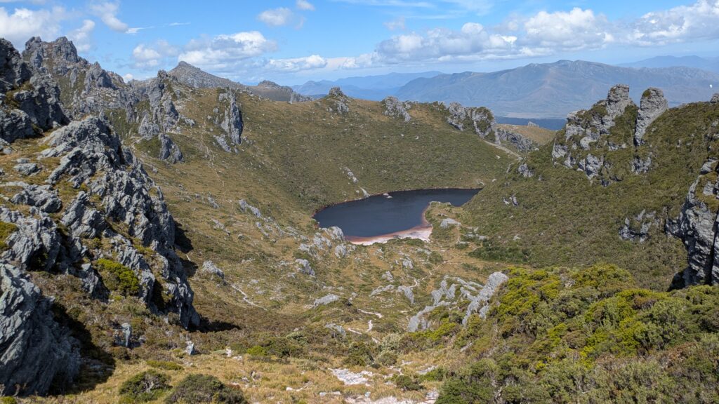
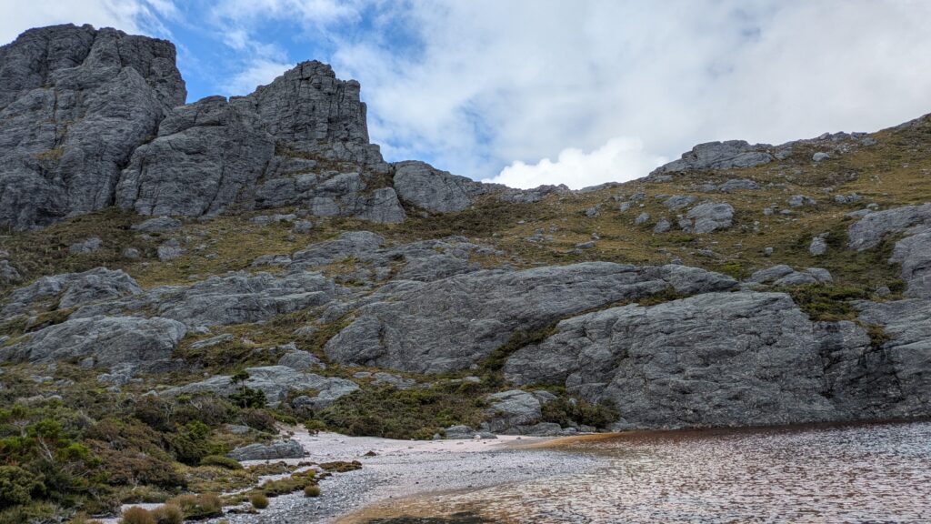
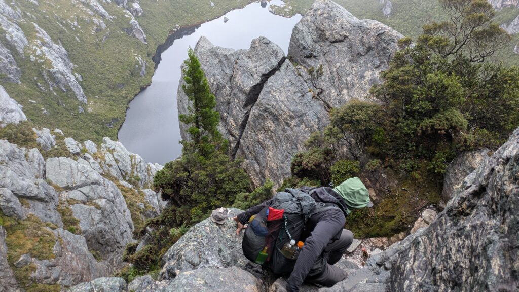
As we passed Square Lake we could just get glimpses of the dark cold water before facing a 200 metre steep hard muddy slog through the dense brush to the saddle that separates Square Lake and Lake Oberon. We carefully negotiated the near-vertical rocky descent to the lake, the rocks slippery wet and footholds no better than dubious, until we made the campsite and set up our tents on another platform. We were soggy and exhausted but learned another lesson – this walk was actually 5.5 kilometres and took us an astonishing 6 hours to complete. That is slow going!
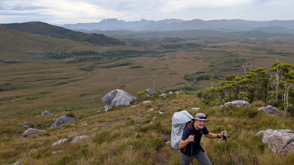
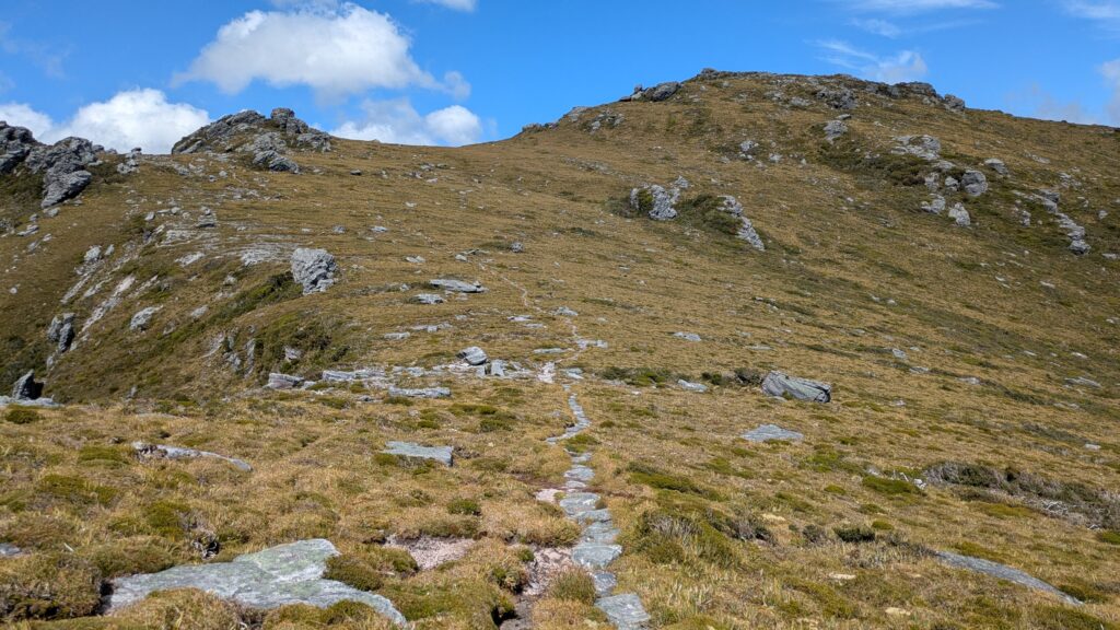
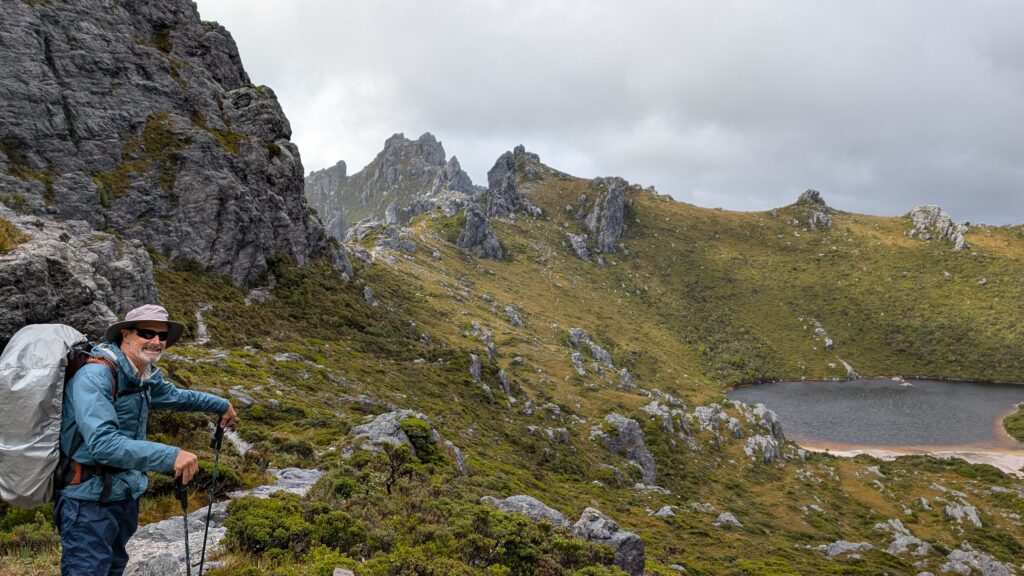
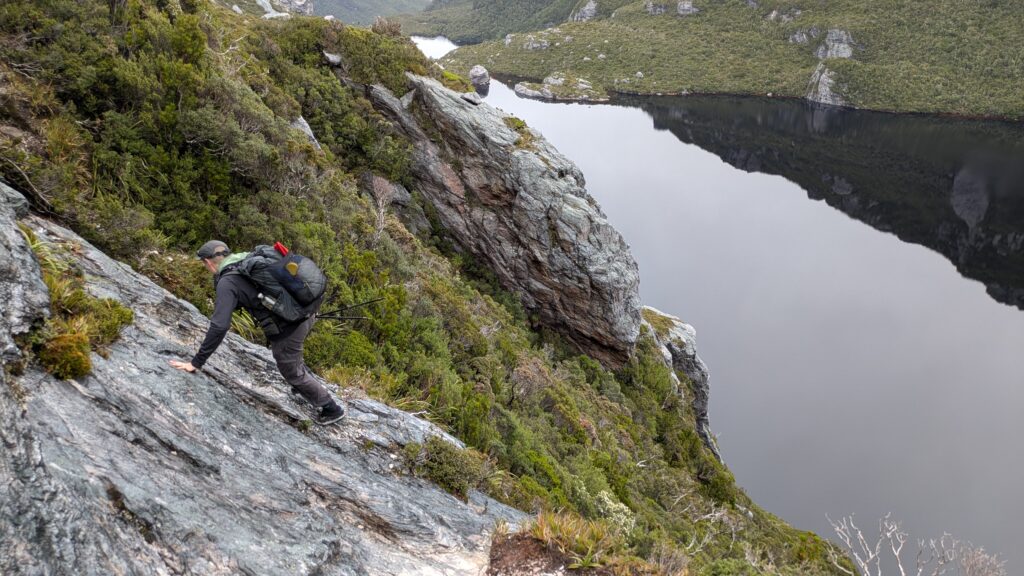
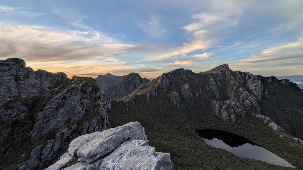
We knew the rugged topography from Lake Oberon to our next camp at High Moor would be some of the most spectacular but also most challenging on our trip so we left camp by 0830 to make the most of the forecasted better weather. The track went ever upward until we eventually topped out at the summit of Mt. Pegasus at 1,064 metres.

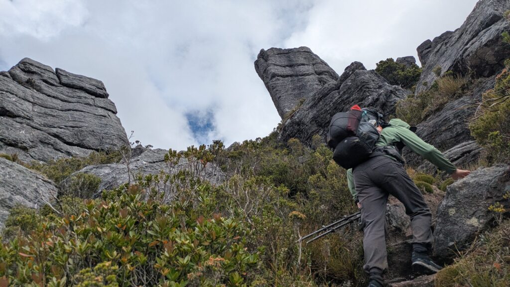
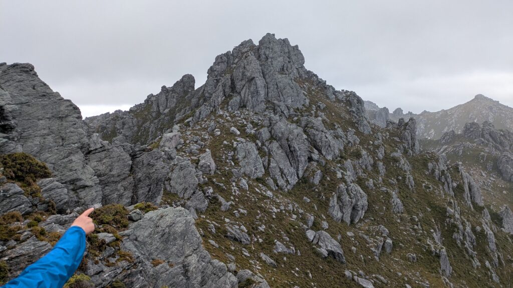
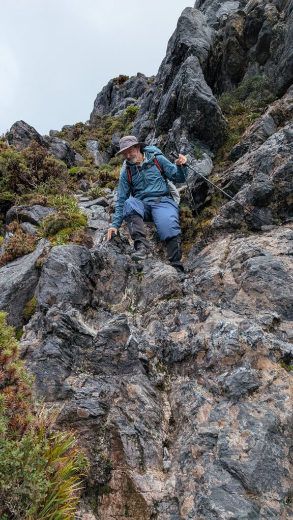
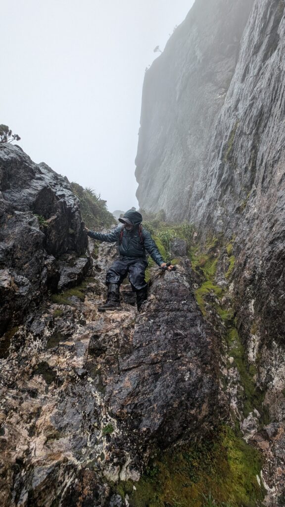
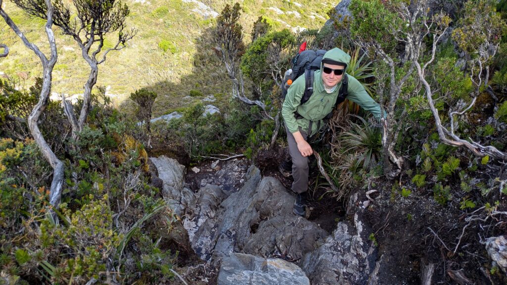
But that climb presented us with immense challenges. At one point the trail ended on a narrow ledge with nothing but 200 metres of daylight below us and a narrow crack in the rock that needed to be scaled above us. With a heavy pack, poor footing and wet rocks I thought the risk was too great for this old body until I noticed a cairn of rocks behind us and an alternative route that bypassed this very risky section. Phew!
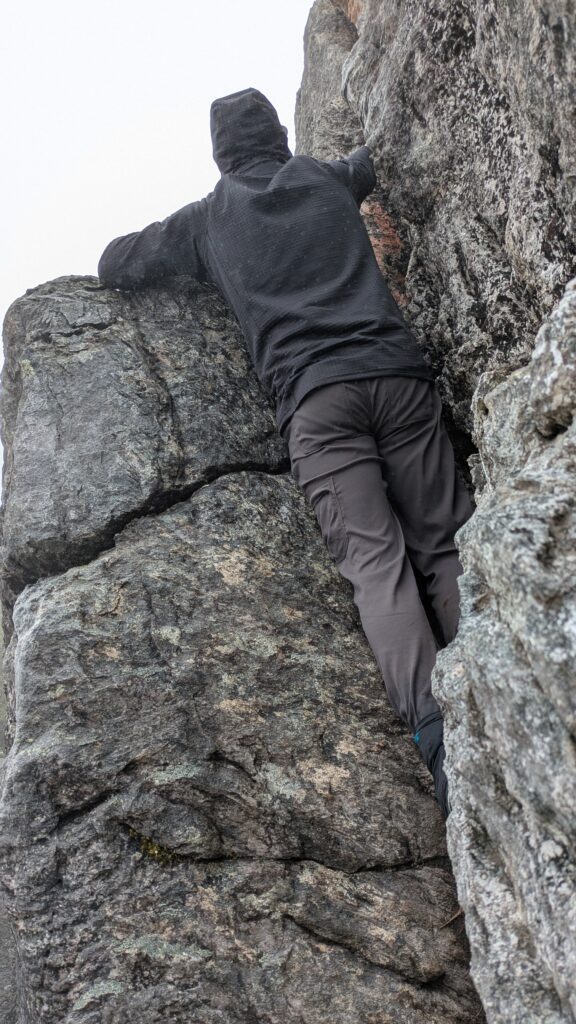
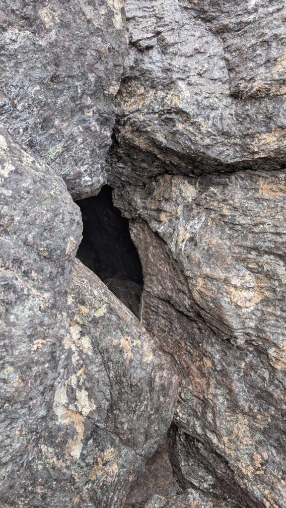
At another point we had to haul our packs through small holes in the rocks and then shimmy up ourselves as there was no other option to move forward. This stuff was hard work and definitely not for the faint-hearted.
The star of the day was Lake Uranus, a large alpine lake below us to our south which took us a couple of hours to pass as our ridgeline and trail negotiated all these hurdles. Any time we were feeling buggered from this section, which was most of the time, we could just look down on the lake knowing it would bring a smile to our face.
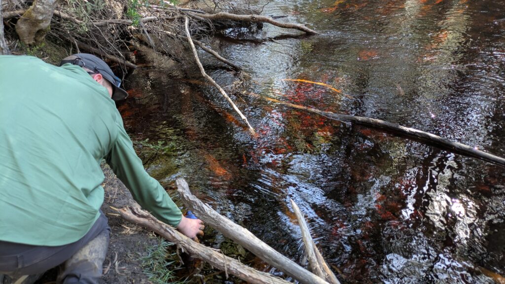
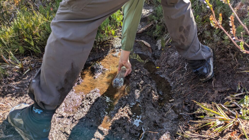
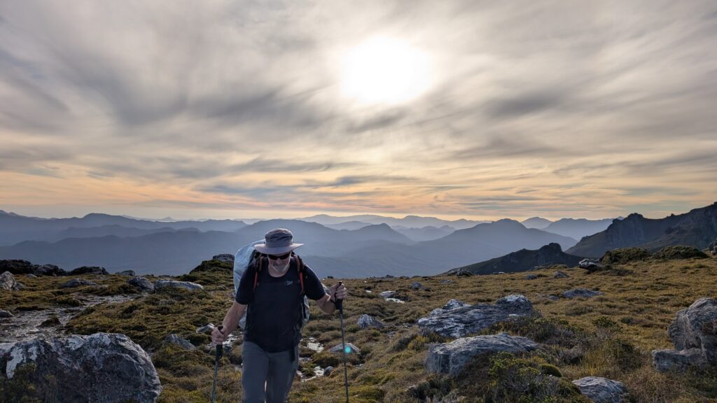
We reached the top of Mt. Capricorn (1037 metres) and that would have been a big day in itself but we still had a fair ways to go. We descended the eastern nose of this rocky mountain peak, following a near-vertical trail through the heavy shrubs and across exposed rocklines. We filled water bottles in some very suspect puddles and then headed up a steep exposed ridge, the sun blazing down on us, the weather always making us laugh or cry.
After a few more ups and downs we finally arrived at the large platforms of our camp at High Moor at 7pm. It had taken us a massive 10.5 hours of hard work to cover only 6.3 kilometres. If you had told me before this trip we would be walking that slow I would have laughed! But what an experience!
As good as it’s been so far we have some of the most challenging and rewarding days still ahead of us. Our tired bodies and wide grins were ready to go!
Comments
The Western Arthur Traverse — No Comments
HTML tags allowed in your comment: <a href="" title=""> <abbr title=""> <acronym title=""> <b> <blockquote cite=""> <cite> <code> <del datetime=""> <em> <i> <q cite=""> <s> <strike> <strong>